Gho Brāhmanān de geodata
Gho Brāhmanān de (Jammu and Kashmir) is a populated place; located in India in Asia/Kolkata (GMT+5.5) time zone. With population of 4,040 people, there are 3377 cities with bigger population in this country. Compared to other cities in India, 98.6% of cities are located further ↓South; 83.2% of cities are located further →East and 69.3% of cities have lower elevation than Gho Brāhmanān de. Note1


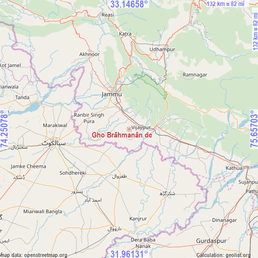
Gho Brāhmanān de GPS coordinates[2]
32° 33' 21.24" North, 74° 57' 14.04" East
| Map corner | latitude | longitude |
|---|---|---|
| Upper-left | 33.14658°, | 74.25078° |
| Center: | 32.5559°, | 74.9539° |
| Lower-right: | 31.96131°, | 75.65703° |
| Map W x H: | 131.8×131.8 km | = 81.9×81.9mi |
| max Lat: | 34.9274° ⇑1.4% North |
| Gho Brāhmanān de: | 32.5559° |
| min Lat: | ⇓98.6% South 8.09008° |
| min Long | Gho Brāhmanān | max Long |
| 68.82655° | 74.9539° | 96.81° |
| W 16.8%⇐ | ⇒83.2% E |
Elevation
Elevation of Gho Brāhmanān de is 320 m = 1050 ft, and this is 24.4 m = 80 ft above average elevation for this country.
| Max E: |
3681 m = 12077 ft | 30.7% |
| Gho Brāhmanān de | 320 m 1050 ft | |
| Avg. | 295.6 m = 970 ft | |
Min E: |
1 m = 3 ft | 69.3% |
See also: India elevation on elevation.city.
Geographical zone
Gho Brāhmanān de is located in North temperate zone (between Tropic of Cancer and the Arctic Circle). Distance of this Northern Tropic circle is 1014 km =630.1 mi to South.| Distance of | km | miles | from Gho Brāhmanān de |
|---|---|---|---|
| North Pole | 6387.2 | 3968.8 | to North |
| Arctic Circle | 3781.3 | 2349.6 | to North |
| Tropic Cancer | 1014 | 630.1 | to South |
| Equator | 3619.9 | 2249.3 | to South |


Nearby cities:
15 places around Gho Brāhmanān de: (largest is in red/bold)
• Akhnūr
40.2 km =25 mi,  329°
329°
• Bishnāh
11 km =6.8 mi,  303°
303°
• Derā Nānak
58.1 km =36.1 mi,  173°
173°
• Hirānagar
31.9 km =19.8 mi,  110°
110°
• Jammu
21.5 km =13.4 mi,  338°
338°
• Jauriān
46.9 km =29.1 mi,  311°
311°
• Kathua
57.5 km =35.7 mi, 111°
• Katra
48.5 km =30.1 mi,  357°
357°
• Khaur
14.5 km =9 mi,  290°
290°
• Nawānshahr
46.2 km =28.7 mi, 300°
• Norīa
15.1 km =9.4 mi,  255°
255°
• Parol
50.8 km =31.6 mi,  117°
117°
• Rāmnagar
43.6 km =27.1 mi,  50°
50°
• Sāmba
15.6 km =9.7 mi,  87°
87°
• Udhampur
44.4 km =27.6 mi,  22°
22°
Sources, notices
• [Note1] Compared only with cities in India existing in our database
• [Src1] Map data: © OpenStreetMap contributors (CC-BY-SA)
• [Src2] Other city data from geonames.org with taken over terms of usage.
• [Src3] Geographical zone / Annual Mean Temperature by Robert A. Rohde @ Wikipedia
