Hirānagar geodata
Hirānagar (Jammu and Kashmir) is a populated place; located in India in Asia/Kolkata (GMT+5.5) time zone. With population of 9,446 people, there are 2998 cities with bigger population in this country. Compared to other cities in India, 98.4% of cities are located further ↓South; 80.5% of cities are located further →East and 69.4% of cities have lower elevation than Hirānagar. Note1


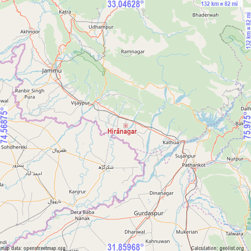
Hirānagar GPS coordinates[2]
32° 27' 17.748" North, 75° 16' 18.732" East
| Map corner | latitude | longitude |
|---|---|---|
| Upper-left | 33.04628°, | 74.56875° |
| Center: | 32.45493°, | 75.27187° |
| Lower-right: | 31.85968°, | 75.975° |
| Map W x H: | 131.9×131.9 km | = 82×82mi |
| max Lat: | 34.9274° ⇑1.6% North |
| Hirānagar: | 32.45493° |
| min Lat: | ⇓98.4% South 8.09008° |
| min Long | Hirānagar | max Long |
| 68.82655° | 75.27187° | 96.81° |
| W 19.5%⇐ | ⇒80.5% E |
Elevation
Elevation of Hirānagar is 321 m = 1053 ft, and this is 25.4 m = 83 ft above average elevation for this country.
| Max E: |
3681 m = 12077 ft | 30.6% |
| Hirānagar | 321 m 1053 ft | |
| Avg. | 295.6 m = 970 ft | |
Min E: |
1 m = 3 ft | 69.4% |
See also: India elevation on elevation.city.
Geographical zone
Hirānagar is located in North temperate zone (between Tropic of Cancer and the Arctic Circle). Distance of this Northern Tropic circle is 1002.7 km =623 mi to South.| Distance of | km | miles | from Hirānagar |
|---|---|---|---|
| North Pole | 6398.4 | 3975.8 | to North |
| Arctic Circle | 3792.5 | 2356.5 | to North |
| Tropic Cancer | 1002.7 | 623 | to South |
| Equator | 3608.6 | 2242.3 | to South |


Nearby cities:
15 places around Hirānagar: (largest is in red/bold)
• Bishnāh
42.7 km =26.5 mi,  293°
293°
• Derā Nānak
51.8 km =32.2 mi,  206°
206°
• Dhāriwāl
55.7 km =34.6 mi,  174°
174°
• Dīnānagar
40.1 km =24.9 mi,  151°
151°
• Gho Brāhmanān de
31.9 km =19.8 mi, 290°
• Jammu
49 km =30.4 mi,  309°
309°
• Kalanaur
50.5 km =31.4 mi,  193°
193°
• Kathua
25.6 km =15.9 mi,  111°
111°
• Khaur
46.4 km =28.8 mi, 290°
• Norīa
45 km =28 mi,  279°
279°
• Parol
19.5 km =12.1 mi,  128°
128°
• Pathānkot
41 km =25.5 mi,  119°
119°
• Rāmnagar
39.4 km =24.5 mi,  5°
5°
• Sāmba
18.6 km =11.6 mi, 310°
• Udhampur
53.7 km =33.4 mi,  346°
346°
Sources, notices
• [Note1] Compared only with cities in India existing in our database
• [Src1] Map data: © OpenStreetMap contributors (CC-BY-SA)
• [Src2] Other city data from geonames.org with taken over terms of usage.
• [Src3] Geographical zone / Annual Mean Temperature by Robert A. Rohde @ Wikipedia
