Qahderījān geodata
Qahderījān (Isfahan) is a populated place; located in Iran in Asia/Tehran (GMT+3.5) time zone. With population of 29,392 people, there are 176 cities with bigger population in this country. Compared to other cities in Iran, 64.4% of cities are located further ↑North; 51.9% of cities are located further ←West and 78.5% of cities have lower elevation than Qahderījān. Note1


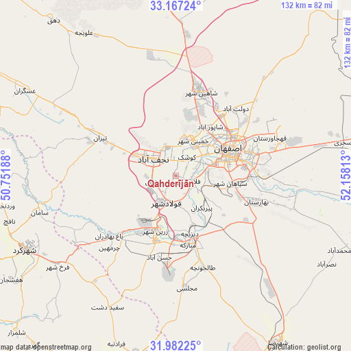
Qahderījān GPS coordinates[2]
32° 34' 36.12" North, 51° 27' 18" East
| Map corner | latitude | longitude |
|---|---|---|
| Upper-left | 33.16724°, | 50.75188° |
| Center: | 32.5767°, | 51.455° |
| Lower-right: | 31.98225°, | 52.15813° |
| Map W x H: | 131.8×131.8 km | = 81.9×81.9mi |
| max Lat: | 39.6482° ⇑64.4% North |
| Qahderījān: | 32.5767° |
| min Lat: | ⇓35.6% South 25.2919° |
| min Long | Qahderījān | max Long |
| 44.38416° | 51.455° | 61.9965° |
| W 51.9%⇐ | ⇒48.1% E |
Elevation
Elevation of Qahderījān is 1613 m = 5292 ft, and this is 564 m = 1850 ft above average elevation for this country.
| Max E: |
2564 m = 8412 ft | 21.5% |
| Qahderījān | 1613 m 5292 ft | |
| Avg. | 1049 m = 3442 ft | |
Min E: |
-24 m = -79 ft | 78.5% |
See also: Iran elevation on elevation.city.
Geographical zone
Qahderījān is located in North temperate zone (between Tropic of Cancer and the Arctic Circle). Distance of this Northern Tropic circle is 1016.3 km =631.5 mi to South.| Distance of | km | miles | from Qahderījān |
|---|---|---|---|
| North Pole | 6384.9 | 3967.4 | to North |
| Arctic Circle | 3779 | 2348.2 | to North |
| Tropic Cancer | 1016.3 | 631.5 | to South |
| Equator | 3622.2 | 2250.7 | to South |


Nearby cities:
15 places around Qahderījān: (largest is in red/bold)
• Abrīsham
11.3 km =7 mi,  101°
101°
• Dorcheh Pīāz
10.4 km =6.5 mi,  65°
65°
• Dowlatābād
33.5 km =20.8 mi,  42°
42°
• Falāvarjān
5.7 km =3.5 mi,  114°
114°
• Farrokh Shahr
56 km =34.8 mi,  232°
232°
• Isfahan
22.2 km =13.8 mi, 67°
• Kelīshād va Sūdarjān
7.4 km =4.6 mi, 112°
• Khomeynī Shahr
14.3 km =8.9 mi,  32°
32°
• Mobārakeh
26 km =16.2 mi,  169°
169°
• Najafābād
10.5 km =6.5 mi,  307°
307°
• Rehnān
18.1 km =11.2 mi,  49°
49°
• Shahr-e Kord
62.6 km =38.9 mi,  243°
243°
• Shāhīn Shahr
32.6 km =20.3 mi,  16°
16°
• Tīrān
31.5 km =19.6 mi,  296°
296°
• Zarrīn Shahr
22.1 km =13.7 mi,  199°
199°
Sources, notices
• [Note1] Compared only with cities in Iran existing in our database
• [Src1] Map data: © OpenStreetMap contributors (CC-BY-SA)
• [Src2] Other city data from geonames.org with taken over terms of usage.
• [Src3] Geographical zone / Annual Mean Temperature by Robert A. Rohde @ Wikipedia
