Patreksfjörður geodata
Patreksfjörður (Westfjords) is a populated place; located in Iceland in Atlantic/Reykjavik (GMT+0) time zone. With population of 651 people, there are 40 cities with bigger population in this country. Compared to other cities in Iceland, 73.9% of cities are located further ↓South; 100% of cities are located further →East and 65.2% of cities have lower elevation than Patreksfjörður. Note1


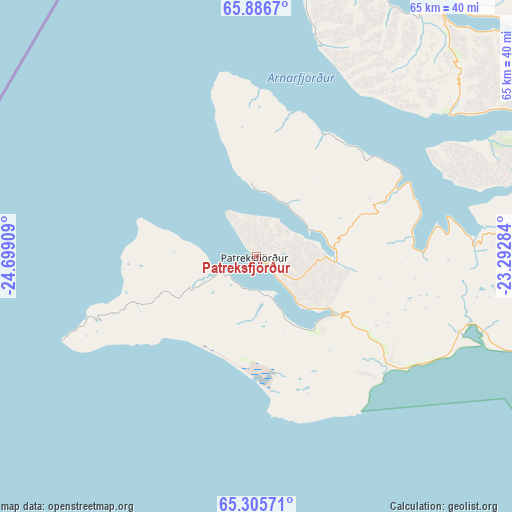
Patreksfjörður GPS coordinates[2]
65° 35' 52.188" North, 23° 59' 45.456" West
| Map corner | latitude | longitude |
|---|---|---|
| Upper-left | 65.8867°, | -24.69909° |
| Center: | 65.59783°, | -23.99596° |
| Lower-right: | 65.30571°, | -23.29284° |
| Map W x H: | 64.6×64.6 km | = 40.1×40.1mi |
| max Lat: | 66.15917° ⇑26.1% North |
| Patreksfjörður: | 65.59783° |
| min Lat: | ⇓73.9% South 63.44273° |
| min Long | Patreksfjörðu | max Long |
| -23.99596° | -23.99596° | -13.68368° |
| W 0%⇐ | ⇒100% E |
Elevation
Elevation of Patreksfjörður is 26 m = 85 ft, and this is 4.7 m = 15 ft above average elevation for this country.
| Max E: |
105 m = 344 ft | 34.8% |
| Patreksfjörður | 26 m 85 ft | |
| Avg. | 21.3 m = 70 ft | |
Min E: |
1 m = 3 ft | 65.2% |
See also: Iceland elevation on elevation.city.
Geographical zone
Patreksfjörður is located in North temperate zone (between Tropic of Cancer and the Arctic Circle). Distance of this North polar circle is 107.4 km =66.7 mi to North.| Distance of | km | miles | from Patreksfjörður |
|---|---|---|---|
| North Pole | 2713.3 | 1686 | to North |
| Arctic Circle | 107.4 | 66.7 | to North |
| Tropic Cancer | 4687.9 | 2912.9 | to South |
| Equator | 7293.8 | 4532.2 | to South |


Nearby cities:
15 places around Patreksfjörður: (largest is in red/bold)
• Akranes
168.2 km =104.5 mi,  147°
147°
• Blönduós
170.6 km =106 mi,  87°
87°
• Bolungarvík
71 km =44.1 mi,  28°
28°
• Borgarnes
152.8 km =94.9 mi,  140°
140°
• Garður
181.9 km =113 mi,  159°
159°
• Grundarfjörður
82.3 km =51.1 mi, 155°
• Grundarhverfi
182 km =113.1 mi, 146°
• Hvammstangi
142.5 km =88.5 mi,  99°
99°
• Keflavík
189.7 km =117.9 mi, 159°
• Sandgerði
183.9 km =114.3 mi, 160°
• Seltjarnarnes
186.3 km =115.8 mi, 149°
• Skagaströnd
170.8 km =106.1 mi,  81°
81°
• Stykkishólmur
82.6 km =51.3 mi,  134°
134°
• Ísafjörður
65.9 km =40.9 mi,  36°
36°
• Ólafsvík
79.4 km =49.3 mi,  170°
170°
Sources, notices
• [Note1] Compared only with cities in Iceland existing in our database
• [Src1] Map data: © OpenStreetMap contributors (CC-BY-SA)
• [Src2] Other city data from geonames.org with taken over terms of usage.
• [Src3] Geographical zone / Annual Mean Temperature by Robert A. Rohde @ Wikipedia
