Bolungarvík geodata
Bolungarvík (Westfjords) is a populated place; located in Iceland in Atlantic/Reykjavik (GMT+0) time zone. With population of 894 people, there are 33 cities with bigger population in this country. Compared to other cities in Iceland, 100% of cities are located further ↓South; 93.5% of cities are located further →East and 54.3% of cities have lower elevation than Bolungarvík. Note1


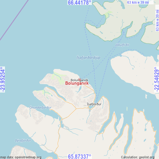
Bolungarvík GPS coordinates[2]
66° 9' 33.012" North, 23° 14' 57.876" West
| Map corner | latitude | longitude |
|---|---|---|
| Upper-left | 66.44178°, | -23.95254° |
| Center: | 66.15917°, | -23.24941° |
| Lower-right: | 65.87337°, | -22.54629° |
| Map W x H: | 63.2×63.2 km | = 39.3×39.3mi |
| max Lat: | 66.15917° ⇑0% North |
| Bolungarvík: | 66.15917° |
| min Lat: | ⇓100% South 63.44273° |
| min Long | Bolungarvík | max Long |
| -23.99596° | -23.24941° | -13.68368° |
| W 6.5%⇐ | ⇒93.5% E |
Elevation
Elevation of Bolungarvík is 20 m = 66 ft, and this is 1.3 m = 4 ft below average elevation for this country.
| Max E: |
105 m = 344 ft | 45.7% |
| Avg. | 21.3 m = 70 ft | |
| Bolungarvík | 20 m = 66 ft | |
Min E: |
1 m = 3 ft | 54.3% |
See also: Iceland elevation on elevation.city.
Geographical zone
Bolungarvík is located in North temperate zone (between Tropic of Cancer and the Arctic Circle). Distance of this North polar circle is 45 km =28 mi to North.| Distance of | km | miles | from Bolungarvík |
|---|---|---|---|
| North Pole | 2650.9 | 1647.2 | to North |
| Arctic Circle | 45 | 28 | to North |
| Tropic Cancer | 4750.3 | 2951.7 | to South |
| Equator | 7356.2 | 4570.9 | to South |


Nearby cities:
15 places around Bolungarvík: (largest is in red/bold)
• Akranes
211.5 km =131.4 mi,  165°
165°
• Blönduós
145.7 km =90.5 mi,  112°
112°
• Borgarnes
190.5 km =118.4 mi,  161°
161°
• Grundarfjörður
137.3 km =85.3 mi,  180°
180°
• Grundarhverfi
223.3 km =138.8 mi, 162°
• Hvammstangi
135.1 km =83.9 mi,  128°
128°
• Mosfellsbær
233 km =144.8 mi, 161°
• Patreksfjörður
71 km =44.1 mi,  208°
208°
• Reykjavík
233.7 km =145.2 mi, 164°
• Sauðárkrókur
169.9 km =105.6 mi, 105°
• Seltjarnarnes
230.6 km =143.3 mi, 165°
• Skagaströnd
138.4 km =86 mi, 105°
• Stykkishólmur
122.8 km =76.3 mi, 168°
• Ísafjörður
10.7 km =6.6 mi,  151°
151°
• Ólafsvík
142.2 km =88.4 mi,  188°
188°
Sources, notices
• [Note1] Compared only with cities in Iceland existing in our database
• [Src1] Map data: © OpenStreetMap contributors (CC-BY-SA)
• [Src2] Other city data from geonames.org with taken over terms of usage.
• [Src3] Geographical zone / Annual Mean Temperature by Robert A. Rohde @ Wikipedia
