Usellus geodata
Usellus (Sardinia) is a seat of a third-order administrative division; located in Italy in Europe/Rome (GMT+2) time zone. With population of 623 people, there are 8818 cities with bigger population in this country. Compared to other cities in Italy, 89% of cities are located further ↑North; 83.5% of cities are located further →East and 55.7% of cities have lower elevation than Usellus. Note1


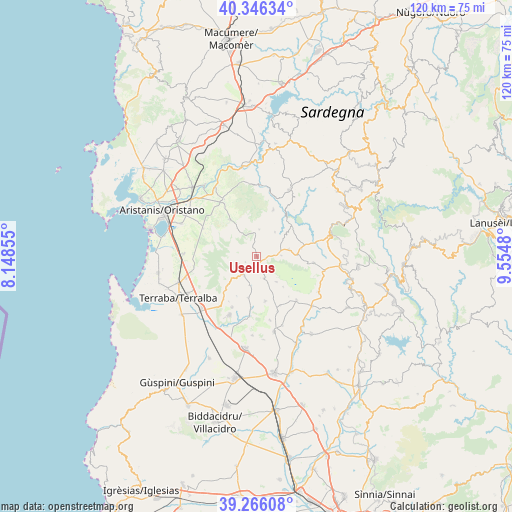
Usellus GPS coordinates[2]
39° 48' 29.988" North, 8° 51' 6.012" East
| Map corner | latitude | longitude |
|---|---|---|
| Upper-left | 40.34634°, | 8.14855° |
| Center: | 39.80833°, | 8.85167° |
| Lower-right: | 39.26608°, | 9.5548° |
| Map W x H: | 120.1×120.1 km | = 74.6×74.6mi |
| max Lat: | 47.04031° ⇑89% North |
| Usellus: | 39.80833° |
| min Lat: | ⇓11% South 35.50142° |
| min Long | Usellus | max Long |
| 6.69888° | 8.85167° | 18.48682° |
| W 16.5%⇐ | ⇒83.5% E |
Elevation
Elevation of Usellus is 270 m = 886 ft, and this is 36.7 m = 120 ft below average elevation for this country.
| Max E: |
2085 m = 6841 ft | 44.3% |
| Avg. | 306.7 m = 1006 ft | |
| Usellus | 270 m = 886 ft | |
Min E: |
-4 m = -13 ft | 55.7% |
See also: Italy elevation on elevation.city.
Geographical zone
Usellus is located in North temperate zone (between Tropic of Cancer and the Arctic Circle). Distance of this Northern Tropic circle is 1820.4 km =1131.1 mi to South.| Distance of | km | miles | from Usellus |
|---|---|---|---|
| North Pole | 5580.8 | 3467.7 | to North |
| Arctic Circle | 2974.9 | 1848.5 | to North |
| Tropic Cancer | 1820.4 | 1131.1 | to South |
| Equator | 4426.3 | 2750.4 | to South |


Nearby cities:
15 places around Usellus: (largest is in red/bold)
• Albagiara
2.5 km =1.6 mi,  159°
159°
• Ales
5.4 km =3.4 mi,  214°
214°
• Assolo
5.8 km =3.6 mi,  89°
89°
• Baradili
10.4 km =6.5 mi, 157°
• Curcuris
7.1 km =4.4 mi,  193°
193°
• Genuri
9.5 km =5.9 mi,  139°
139°
• Gonnosnò
5.5 km =3.4 mi, 162°
• Mogorella
6.3 km =3.9 mi,  5°
5°
• Morgongiori
9.8 km =6.1 mi,  225°
225°
• Pau
4.6 km =2.9 mi,  246°
246°
• Senis
7.7 km =4.8 mi,  77°
77°
• Simala
9.9 km =6.2 mi, 191°
• Sini
7.6 km =4.7 mi, 143°
• Villa Sant'Antonio
7.1 km =4.4 mi,  36°
36°
• Villa Verde
3 km =1.9 mi,  241°
241°
Sources, notices
• [Note1] Compared only with cities in Italy existing in our database
• [Src1] Map data: © OpenStreetMap contributors (CC-BY-SA)
• [Src2] Other city data from geonames.org with taken over terms of usage.
• [Src3] Geographical zone / Annual Mean Temperature by Robert A. Rohde @ Wikipedia
