San Giovanni Suergiu geodata
San Giovanni Suergiu (Sardinia) is a seat of a third-order administrative division; located in Italy in Europe/Rome (GMT+2) time zone. With population of 3,198 people, there are 2898 cities with bigger population in this country. Compared to other cities in Italy, 92.2% of cities are located further ↑North; 87.7% of cities are located further →East and 89.6% of cities have higher elevation than San Giovanni Suergiu. Note1
Administrative division(s):
- Level 1: Sardinia
- Level 2: Provincia del Sud Sardegna
- Level 3: San Giovanni Suergiu
Current local time in San Giovanni Suergiu:
07:58 PM, WednesdayDifference from your time zone: hours


San Giovanni Suergiu GPS coordinates[2]
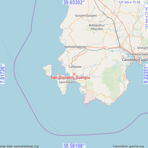
39° 6' 34.38" North, 8° 31' 13.404" East
| Map corner | latitude | longitude |
|---|---|---|
| Upper-left | 39.65302°, | 7.81726° |
| Center: | 39.10955°, | 8.52039° |
| Lower-right: | 38.56186°, | 9.22351° |
| Map W x H: | 121.3×121.3 km | = 75.4×75.4mi |
| max Lat: | 47.04031° ⇑92.2% North |
| San Giovanni Suergiu: | 39.10955° |
| min Lat: | ⇓7.8% South 35.50142° |
| min Long | San Giovanni Su | max Long |
| 6.69888° | 8.52039° | 18.48682° |
| W 12.3%⇐ | ⇒87.7% E |
Elevation
Elevation of San Giovanni Suergiu is 19 m = 62 ft, and this is 287.7 m = 944 ft below average elevation for this country.
| Max E: |
2085 m = 6841 ft | 89.6% |
| Avg. | 306.7 m = 1006 ft | |
| San Giovanni Suergiu | 19 m = 62 ft | |
Min E: |
-4 m = -13 ft | 10.4% |
See also: Italy elevation on elevation.city.
Geographical zone
San Giovanni Suergiu is located in North temperate zone (between Tropic of Cancer and the Arctic Circle). Distance of this Northern Tropic circle is 1742.7 km =1082.9 mi to South.| Distance of | km | miles | from San Giovanni Suergiu |
|---|---|---|---|
| North Pole | 5658.5 | 3516 | to North |
| Arctic Circle | 3052.6 | 1896.8 | to North |
| Tropic Cancer | 1742.7 | 1082.9 | to South |
| Equator | 4348.6 | 2702.1 | to South |


Nearby cities:
15 places around San Giovanni Suergiu: (largest is in red/bold)
• Barbusi
10.4 km =6.5 mi,  353°
353°
• Calasetta
13.1 km =8.1 mi,  268°
268°
• Carbonia
6.1 km =3.8 mi,  0°
0°
• Cortoghiana
12.3 km =7.6 mi,  337°
337°
• Giba
10.8 km =6.7 mi,  113°
113°
• Is Urigus
3.6 km =2.2 mi,  321°
321°
• Masainas
11.5 km =7.1 mi,  125°
125°
• Matzaccara
6.3 km =3.9 mi,  293°
293°
• Nuraxi Figus
14.7 km =9.1 mi,  329°
329°
• Paringianu
10.6 km =6.6 mi,  312°
312°
• Perdaxius
9.6 km =6 mi,  54°
54°
• Piscinas
13.2 km =8.2 mi, 107°
• Sant'Antioco
7.3 km =4.5 mi,  233°
233°
• Tratalias
5.1 km =3.2 mi,  97°
97°
• Villaperuccio
12.9 km =8 mi,  88°
88°
Sources, notices
• [Note1] Compared only with cities in Italy existing in our database
• [Src1] Map data: © OpenStreetMap contributors (CC-BY-SA)
• [Src2] Other city data from geonames.org with taken over terms of usage.
• [Src3] Geographical zone / Annual Mean Temperature by Robert A. Rohde @ Wikipedia
