Cortoghiana geodata
Cortoghiana (Sardinia) is a populated place; located in Italy in Europe/Rome (GMT+2) time zone. With population of 2,478 people, there are 3548 cities with bigger population in this country. Compared to other cities in Italy, 91.8% of cities are located further ↑North; 88.3% of cities are located further →East and 70.6% of cities have higher elevation than Cortoghiana. Note1


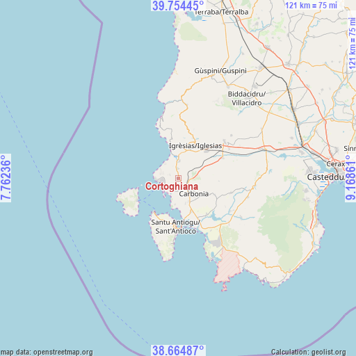
Cortoghiana GPS coordinates[2]
39° 12' 42.372" North, 8° 27' 55.728" East
| Map corner | latitude | longitude |
|---|---|---|
| Upper-left | 39.75445°, | 7.76236° |
| Center: | 39.21177°, | 8.46548° |
| Lower-right: | 38.66487°, | 9.16861° |
| Map W x H: | 121.1×121.1 km | = 75.2×75.2mi |
| max Lat: | 47.04031° ⇑91.8% North |
| Cortoghiana: | 39.21177° |
| min Lat: | ⇓8.2% South 35.50142° |
| min Long | Cortoghiana | max Long |
| 6.69888° | 8.46548° | 18.48682° |
| W 11.7%⇐ | ⇒88.3% E |
Elevation
Elevation of Cortoghiana is 94 m = 308 ft, and this is 212.7 m = 698 ft below average elevation for this country.
| Max E: |
2085 m = 6841 ft | 70.6% |
| Avg. | 306.7 m = 1006 ft | |
| Cortoghiana | 94 m = 308 ft | |
Min E: |
-4 m = -13 ft | 29.4% |
See also: Italy elevation on elevation.city.
Geographical zone
Cortoghiana is located in North temperate zone (between Tropic of Cancer and the Arctic Circle). Distance of this Northern Tropic circle is 1754 km =1089.9 mi to South.| Distance of | km | miles | from Cortoghiana |
|---|---|---|---|
| North Pole | 5647.1 | 3508.9 | to North |
| Arctic Circle | 3041.2 | 1889.7 | to North |
| Tropic Cancer | 1754 | 1089.9 | to South |
| Equator | 4359.9 | 2709.1 | to South |


Nearby cities:
15 places around Cortoghiana: (largest is in red/bold)
• Bacu Abis
3.5 km =2.2 mi,  359°
359°
• Barbusi
3.8 km =2.4 mi,  106°
106°
• Calasetta
14.4 km =8.9 mi,  215°
215°
• Carbonia
7.1 km =4.4 mi,  137°
137°
• Gonnesa
6 km =3.7 mi,  4°
4°
• Iglesias
12.5 km =7.8 mi,  29°
29°
• Is Urigus
8.9 km =5.5 mi,  163°
163°
• Matzaccara
8.9 km =5.5 mi,  186°
186°
• Nebida
11.6 km =7.2 mi,  348°
348°
• Nuraxi Figus
3 km =1.9 mi,  293°
293°
• Paringianu
5.1 km =3.2 mi, 216°
• Perdaxius
13.8 km =8.6 mi, 114°
• Portoscuso
7.3 km =4.5 mi,  266°
266°
• San Giovanni Suergiu
12.3 km =7.6 mi, 157°
• Tratalias
15.5 km =9.6 mi, 141°
Sources, notices
• [Note1] Compared only with cities in Italy existing in our database
• [Src1] Map data: © OpenStreetMap contributors (CC-BY-SA)
• [Src2] Other city data from geonames.org with taken over terms of usage.
• [Src3] Geographical zone / Annual Mean Temperature by Robert A. Rohde @ Wikipedia
