Perdaxius geodata
Perdaxius (Sardinia) is a seat of a third-order administrative division; located in Italy in Europe/Rome (GMT+2) time zone. With population of 842 people, there are 7438 cities with bigger population in this country. Compared to other cities in Italy, 92% of cities are located further ↑North; 86.6% of cities are located further →East and 70.4% of cities have higher elevation than Perdaxius. Note1
Administrative division(s):
- Level 1: Sardinia
- Level 2: Provincia del Sud Sardegna
- Level 3: Perdaxius


Perdaxius GPS coordinates[2]
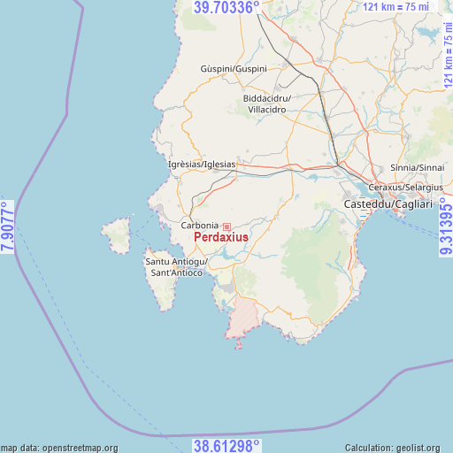
39° 9' 37.008" North, 8° 36' 38.988" East
| Map corner | latitude | longitude |
|---|---|---|
| Upper-left | 39.70336°, | 7.9077° |
| Center: | 39.16028°, | 8.61083° |
| Lower-right: | 38.61298°, | 9.31395° |
| Map W x H: | 121.2×121.2 km | = 75.3×75.3mi |
| max Lat: | 47.04031° ⇑92% North |
| Perdaxius: | 39.16028° |
| min Lat: | ⇓8% South 35.50142° |
| min Long | Perdaxius | max Long |
| 6.69888° | 8.61083° | 18.48682° |
| W 13.4%⇐ | ⇒86.6% E |
Elevation
Elevation of Perdaxius is 95 m = 312 ft, and this is 211.7 m = 695 ft below average elevation for this country.
| Max E: |
2085 m = 6841 ft | 70.4% |
| Avg. | 306.7 m = 1006 ft | |
| Perdaxius | 95 m = 312 ft | |
Min E: |
-4 m = -13 ft | 29.6% |
See also: Italy elevation on elevation.city.
Geographical zone
Perdaxius is located in North temperate zone (between Tropic of Cancer and the Arctic Circle). Distance of this Northern Tropic circle is 1748.3 km =1086.3 mi to South.| Distance of | km | miles | from Perdaxius |
|---|---|---|---|
| North Pole | 5652.8 | 3512.5 | to North |
| Arctic Circle | 3047 | 1893.3 | to North |
| Tropic Cancer | 1748.3 | 1086.3 | to South |
| Equator | 4354.2 | 2705.6 | to South |


Nearby cities:
15 places around Perdaxius: (largest is in red/bold)
• Barbusi
10.1 km =6.3 mi,  297°
297°
• Carbonia
7.7 km =4.8 mi,  273°
273°
• Cortoghiana
13.8 km =8.6 mi,  294°
294°
• Giba
10.1 km =6.3 mi,  167°
167°
• Is Urigus
10.4 km =6.5 mi,  254°
254°
• Masainas
12.4 km =7.7 mi, 172°
• Narcao
5.6 km =3.5 mi,  81°
81°
• Nuxis
11.1 km =6.9 mi,  93°
93°
• Piscinas
10.7 km =6.6 mi,  153°
153°
• Riomurtas
8.5 km =5.3 mi, 75°
• San Giovanni Suergiu
9.6 km =6 mi,  234°
234°
• Santadi
11.5 km =7.1 mi,  130°
130°
• Tratalias
6.9 km =4.3 mi,  203°
203°
• Villamassargia
13 km =8.1 mi,  11°
11°
• Villaperuccio
7.4 km =4.6 mi,  136°
136°
Sources, notices
• [Note1] Compared only with cities in Italy existing in our database
• [Src1] Map data: © OpenStreetMap contributors (CC-BY-SA)
• [Src2] Other city data from geonames.org with taken over terms of usage.
• [Src3] Geographical zone / Annual Mean Temperature by Robert A. Rohde @ Wikipedia
