Gagliano Castelferrato geodata
Gagliano Castelferrato (Sicily) is a seat of a third-order administrative division; located in Italy in Europe/Rome (GMT+2) time zone. With population of 3,427 people, there are 2736 cities with bigger population in this country. Compared to other cities in Italy, 98.1% of cities are located further ↑North; 83% of cities are located further ←West and 87.5% of cities have lower elevation than Gagliano Castelferrato. Note1
Current local time in Gagliano Castelferrato:
12:33 AM, ThursdayDifference from your time zone: hours


Gagliano Castelferrato GPS coordinates[2]
37° 42' 34.812" North, 14° 32' 6.864" East
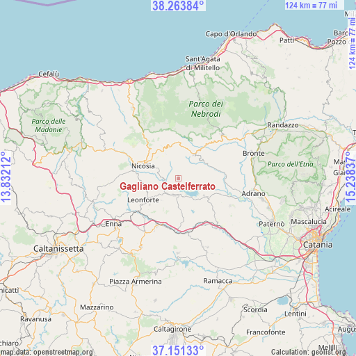
| Map corner | latitude | longitude |
|---|---|---|
| Upper-left | 38.26384°, | 13.83212° |
| Center: | 37.70967°, | 14.53524° |
| Lower-right: | 37.15133°, | 15.23837° |
| Map W x H: | 123.7×123.7 km | = 76.9×76.9mi |
| max Lat: | 47.04031° ⇑98.1% North |
| Gagliano Castelferrato: | 37.70967° |
| min Lat: | ⇓1.9% South 35.50142° |
| min Long | Gagliano Castel | max Long |
| 6.69888° | 14.53524° | 18.48682° |
| W 83%⇐ | ⇒17% E |
Elevation
Elevation of Gagliano Castelferrato is 662 m = 2172 ft, and this is 355.3 m = 1166 ft above average elevation for this country.
| Max E: |
2085 m = 6841 ft | 12.5% |
| Gagliano Castelferrato | 662 m 2172 ft | |
| Avg. | 306.7 m = 1006 ft | |
Min E: |
-4 m = -13 ft | 87.5% |
See also: Italy elevation on elevation.city.
Geographical zone
Gagliano Castelferrato is located in North temperate zone (between Tropic of Cancer and the Arctic Circle). Distance of this Northern Tropic circle is 1587 km =986.1 mi to South.| Distance of | km | miles | from Gagliano Castelferrato |
|---|---|---|---|
| North Pole | 5814.1 | 3612.7 | to North |
| Arctic Circle | 3208.3 | 1993.5 | to North |
| Tropic Cancer | 1587 | 986.1 | to South |
| Equator | 4192.9 | 2605.3 | to South |


Nearby cities:
15 places around Gagliano Castelferrato: (largest is in red/bold)
• Agira
6.1 km =3.8 mi,  192°
192°
• Assoro
14.2 km =8.8 mi,  226°
226°
• Capizzi
16.1 km =10 mi,  342°
342°
• Catenanuova
20.8 km =12.9 mi,  138°
138°
• Centuripe
20.5 km =12.7 mi,  117°
117°
• Cerami
11.4 km =7.1 mi,  347°
347°
• Crociate
12.7 km =7.9 mi,  293°
293°
• Leonforte
14.3 km =8.9 mi,  238°
238°
• Nicosia
13.3 km =8.3 mi, 288°
• Nissoria
9.8 km =6.1 mi, 231°
• Regalbuto
11.2 km =7 mi,  125°
125°
• San Giorgio
9.7 km =6 mi,  217°
217°
• San Teodoro
21 km =13 mi,  43°
43°
• Sperlinga
17.4 km =10.8 mi, 291°
• Troina
9.9 km =6.2 mi,  32°
32°
Sources, notices
• [Note1] Compared only with cities in Italy existing in our database
• [Src1] Map data: © OpenStreetMap contributors (CC-BY-SA)
• [Src2] Other city data from geonames.org with taken over terms of usage.
• [Src3] Geographical zone / Annual Mean Temperature by Robert A. Rohde @ Wikipedia
