Borgia geodata
Borgia (Calabria) is a seat of a third-order administrative division; located in Italy in Europe/Rome (GMT+2) time zone. With population of 4,118 people, there are 2328 cities with bigger population in this country. Compared to other cities in Italy, 93.1% of cities are located further ↑North; 96.5% of cities are located further ←West and 64.5% of cities have lower elevation than Borgia. Note1


Borgia GPS coordinates[2]
38° 49' 34.572" North, 16° 30' 27.72" East
| Map corner | latitude | longitude |
|---|---|---|
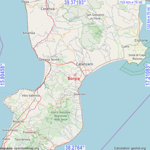
| Upper-left | 39.37193°, | 15.80458° |
| Center: | 38.82627°, | 16.5077° |
| Lower-right: | 38.2764°, | 17.21083° |
| Map W x H: | 121.8×121.8 km | = 75.7×75.7mi |
| max Lat: | 47.04031° ⇑93.1% North |
| Borgia: | 38.82627° |
| min Lat: | ⇓6.9% South 35.50142° |
| min Long | Borgia | max Long |
| 6.69888° | 16.5077° | 18.48682° |
| W 96.5%⇐ | ⇒3.5% E |
Elevation
Elevation of Borgia is 338 m = 1109 ft, and this is 31.3 m = 103 ft above average elevation for this country.
| Max E: |
2085 m = 6841 ft | 35.5% |
| Borgia | 338 m 1109 ft | |
| Avg. | 306.7 m = 1006 ft | |
Min E: |
-4 m = -13 ft | 64.5% |
See also: Italy elevation on elevation.city.
Geographical zone
Borgia is located in North temperate zone (between Tropic of Cancer and the Arctic Circle). Distance of this Northern Tropic circle is 1711.2 km =1063.3 mi to South.| Distance of | km | miles | from Borgia |
|---|---|---|---|
| North Pole | 5690 | 3535.6 | to North |
| Arctic Circle | 3084.1 | 1916.4 | to North |
| Tropic Cancer | 1711.2 | 1063.3 | to South |
| Equator | 4317.1 | 2682.5 | to South |


Nearby cities:
15 places around Borgia: (largest is in red/bold)
• Amaroni
6.3 km =3.9 mi,  235°
235°
• Caraffa di Catanzaro
6.5 km =4 mi,  343°
343°
• Cortale
8.6 km =5.3 mi,  280°
280°
• Gasperina
9.5 km =5.9 mi,  180°
180°
• Germaneto
8.8 km =5.5 mi,  42°
42°
• Girifalco
7 km =4.3 mi,  269°
269°
• Martelletto
7.6 km =4.7 mi,  17°
17°
• Montauro
8.6 km =5.3 mi, 177°
• Roccelletta
8 km =5 mi,  102°
102°
• San Floro
1.6 km =1 mi, 36°
• Settingiano
9.5 km =5.9 mi,  3°
3°
• Squillace
5.1 km =3.2 mi, 176°
• Squillace Lido
7.6 km =4.7 mi,  134°
134°
• Staletti
7.4 km =4.6 mi,  158°
158°
• Vallefiorita
6.9 km =4.3 mi,  216°
216°
Sources, notices
• [Note1] Compared only with cities in Italy existing in our database
• [Src1] Map data: © OpenStreetMap contributors (CC-BY-SA)
• [Src2] Other city data from geonames.org with taken over terms of usage.
• [Src3] Geographical zone / Annual Mean Temperature by Robert A. Rohde @ Wikipedia
