Villotta geodata
Villotta (Friuli Venezia Giulia) is a seat of a third-order administrative division; located in Italy in Europe/Rome (GMT+2) time zone. With population of 1,397 people, there are 5368 cities with bigger population in this country. Compared to other cities in Italy, 88.1% of cities are located further ↓South; 65.7% of cities are located further ←West and 92.1% of cities have higher elevation than Villotta. Note1
Administrative division(s):
- Level 1: Friuli Venezia Giulia
- Level 2: Provincia di Pordenone
- Level 3: Chions


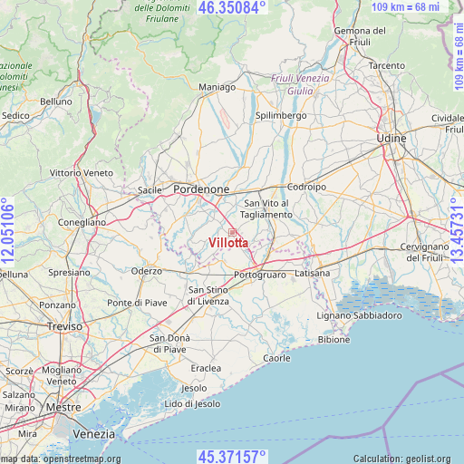
Villotta GPS coordinates[2]
45° 51' 48.096" North, 12° 45' 15.048" East
| Map corner | latitude | longitude |
|---|---|---|
| Upper-left | 46.35084°, | 12.05106° |
| Center: | 45.86336°, | 12.75418° |
| Lower-right: | 45.37157°, | 13.45731° |
| Map W x H: | 108.9×108.9 km | = 67.7×67.7mi |
| max Lat: | 47.04031° ⇑11.9% North |
| Villotta: | 45.86336° |
| min Lat: | ⇓88.1% South 35.50142° |
| min Long | Villotta | max Long |
| 6.69888° | 12.75418° | 18.48682° |
| W 65.7%⇐ | ⇒34.3% E |
Elevation
Elevation of Villotta is 14 m = 46 ft, and this is 292.7 m = 960 ft below average elevation for this country.
| Max E: |
2085 m = 6841 ft | 92.1% |
| Avg. | 306.7 m = 1006 ft | |
| Villotta | 14 m = 46 ft | |
Min E: |
-4 m = -13 ft | 7.9% |
See also: Italy elevation on elevation.city.
Geographical zone
Villotta is located in North temperate zone (between Tropic of Cancer and the Arctic Circle). Distance of this North polar circle is 2301.6 km =1430.1 mi to North.| Distance of | km | miles | from Villotta |
|---|---|---|---|
| North Pole | 4907.5 | 3049.4 | to North |
| Arctic Circle | 2301.6 | 1430.1 | to North |
| Tropic Cancer | 2493.6 | 1549.5 | to South |
| Equator | 5099.5 | 3168.7 | to South |


Nearby cities:
15 places around Villotta: (largest is in red/bold)
• Bagnarola
8.1 km =5 mi,  87°
87°
• Barco
8.1 km =5 mi,  232°
232°
• Chions
3.8 km =2.4 mi,  238°
238°
• Cinque Strade-Cimpello
7.3 km =4.5 mi,  324°
324°
• Cinto Caomaggiore
4.5 km =2.8 mi,  152°
152°
• Fagnigola
5.5 km =3.4 mi,  259°
259°
• Fiume Veneto
7.4 km =4.6 mi,  350°
350°
• Giai
7.5 km =4.7 mi,  137°
137°
• Gruaro
7.4 km =4.6 mi,  115°
115°
• Gruaro-Bagnara
7.9 km =4.9 mi,  107°
107°
• Pramaggiore
5.5 km =3.4 mi,  192°
192°
• Pramaggiore Blessaglia
6.8 km =4.2 mi,  199°
199°
• Pravisdomini
6.7 km =4.2 mi,  223°
223°
• Savorgnano
8.5 km =5.3 mi,  64°
64°
• Sesto al Reghena
4.8 km =3 mi, 108°
Sources, notices
• [Note1] Compared only with cities in Italy existing in our database
• [Src1] Map data: © OpenStreetMap contributors (CC-BY-SA)
• [Src2] Other city data from geonames.org with taken over terms of usage.
• [Src3] Geographical zone / Annual Mean Temperature by Robert A. Rohde @ Wikipedia
