Villafontana geodata
Villafontana (Veneto) is a populated place; located in Italy in Europe/Rome (GMT+2) time zone. With population of 590 people, there are 9093 cities with bigger population in this country. Compared to other cities in Italy, 67.3% of cities are located further ↓South; 56.1% of cities are located further →East and 85.6% of cities have higher elevation than Villafontana. Note1


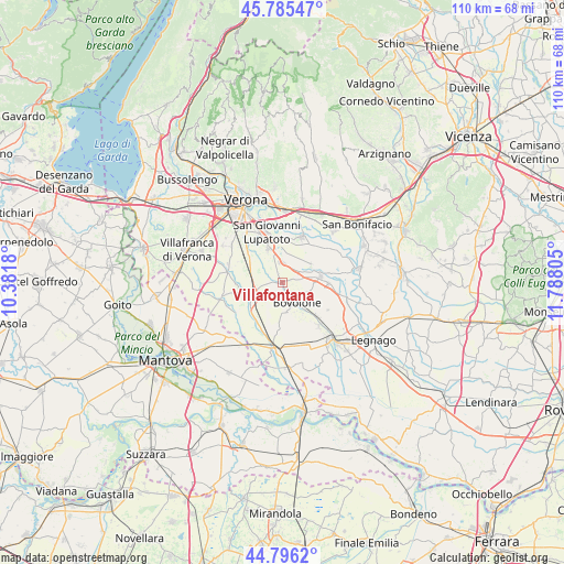
Villafontana GPS coordinates[2]
45° 17' 34.764" North, 11° 5' 5.712" East
| Map corner | latitude | longitude |
|---|---|---|
| Upper-left | 45.78547°, | 10.3818° |
| Center: | 45.29299°, | 11.08492° |
| Lower-right: | 44.7962°, | 11.78805° |
| Map W x H: | 110×110 km | = 68.4×68.4mi |
| max Lat: | 47.04031° ⇑32.7% North |
| Villafontana: | 45.29299° |
| min Lat: | ⇓67.3% South 35.50142° |
| min Long | Villafontana | max Long |
| 6.69888° | 11.08492° | 18.48682° |
| W 43.9%⇐ | ⇒56.1% E |
Elevation
Elevation of Villafontana is 29 m = 95 ft, and this is 277.7 m = 911 ft below average elevation for this country.
| Max E: |
2085 m = 6841 ft | 85.6% |
| Avg. | 306.7 m = 1006 ft | |
| Villafontana | 29 m = 95 ft | |
Min E: |
-4 m = -13 ft | 14.4% |
See also: Italy elevation on elevation.city.
Geographical zone
Villafontana is located in North temperate zone (between Tropic of Cancer and the Arctic Circle). Distance of this North polar circle is 2365.1 km =1469.6 mi to North.| Distance of | km | miles | from Villafontana |
|---|---|---|---|
| North Pole | 4971 | 3088.8 | to North |
| Arctic Circle | 2365.1 | 1469.6 | to North |
| Tropic Cancer | 2430.2 | 1510.1 | to South |
| Equator | 5036.1 | 3129.3 | to South |


Nearby cities:
15 places around Villafontana: (largest is in red/bold)
• Bonavicina
9.5 km =5.9 mi,  124°
124°
• Bovolone
4.4 km =2.7 mi,  143°
143°
• Buttapietra
8.6 km =5.3 mi,  308°
308°
• Ca' degli Oppi
3.6 km =2.2 mi,  85°
85°
• Campagnola
7.8 km =4.8 mi,  339°
339°
• Isola Rizza
8.9 km =5.5 mi, 90°
• Isola della Scala
6.5 km =4 mi,  246°
246°
• Oppeano
7.5 km =4.7 mi,  81°
81°
• Palù
6.6 km =4.1 mi,  57°
57°
• Pellegrina
8.8 km =5.5 mi,  215°
215°
• Raldon
7.3 km =4.5 mi,  329°
329°
• Salizzole
5.9 km =3.7 mi,  172°
172°
• Tarmassia
3.4 km =2.1 mi, 222°
• Vallese
3.9 km =2.4 mi,  1°
1°
• Zevio
9.5 km =5.9 mi,  21°
21°
Sources, notices
• [Note1] Compared only with cities in Italy existing in our database
• [Src1] Map data: © OpenStreetMap contributors (CC-BY-SA)
• [Src2] Other city data from geonames.org with taken over terms of usage.
• [Src3] Geographical zone / Annual Mean Temperature by Robert A. Rohde @ Wikipedia
