Raldon geodata
Raldon (Veneto) is a populated place; located in Italy in Europe/Rome (GMT+1) time zone. With population of 3,830 people, there are 2491 cities with bigger population in this country. Compared to other cities in Italy, 68.8% of cities are located further ↓South; 56.7% of cities are located further →East and 83.7% of cities have higher elevation than Raldon. Note1
Administrative division(s):
- Level 1: Veneto
- Level 2: Provincia di Verona
- Level 3: San Giovanni Lupatoto


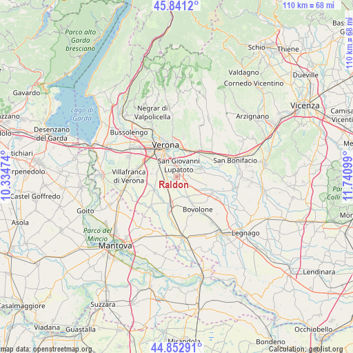
Raldon GPS coordinates[2]
45° 20' 57.156" North, 11° 2' 16.296" East
| Map corner | latitude | longitude |
|---|---|---|
| Upper-left | 45.8412°, | 10.33474° |
| Center: | 45.34921°, | 11.03786° |
| Lower-right: | 44.85291°, | 11.74099° |
| Map W x H: | 109.9×109.9 km | = 68.3×68.3mi |
| max Lat: | 47.04031° ⇑31.2% North |
| Raldon: | 45.34921° |
| min Lat: | ⇓68.8% South 35.50142° |
| min Long | Raldon | max Long |
| 6.69888° | 11.03786° | 18.48682° |
| W 43.3%⇐ | ⇒56.7% E |
Elevation
Elevation of Raldon is 35 m = 115 ft, and this is 271.7 m = 891 ft below average elevation for this country.
| Max E: |
2085 m = 6841 ft | 83.7% |
| Avg. | 306.7 m = 1006 ft | |
| Raldon | 35 m = 115 ft | |
Min E: |
-4 m = -13 ft | 16.3% |
See also: Italy elevation on elevation.city.
Geographical zone
Raldon is located in North temperate zone (between Tropic of Cancer and the Arctic Circle). Distance of this North polar circle is 2358.8 km =1465.7 mi to North.| Distance of | km | miles | from Raldon |
|---|---|---|---|
| North Pole | 4964.7 | 3084.9 | to North |
| Arctic Circle | 2358.8 | 1465.7 | to North |
| Tropic Cancer | 2436.4 | 1513.9 | to South |
| Equator | 5042.4 | 3133.2 | to South |


Nearby cities:
15 places around Raldon: (largest is in red/bold)
• Beccacivetta-Azzano
6.6 km =4.1 mi,  295°
295°
• Buttapietra
3.2 km =2 mi,  253°
253°
• Campagnola
1.4 km =0.9 mi,  42°
42°
• Forette
7.3 km =4.5 mi,  263°
263°
• Isola della Scala
9.2 km =5.7 mi,  194°
194°
• Isolalta
9.1 km =5.7 mi, 261°
• Marchesino-Bovo
3.5 km =2.2 mi, 303°
• San Giovanni Lupatoto
3.7 km =2.3 mi,  8°
8°
• San Martino Buon Albergo
9.2 km =5.7 mi,  29°
29°
• San Pancrazio
8.5 km =5.3 mi,  351°
351°
• Tarmassia
8.8 km =5.5 mi,  170°
170°
• Vallese
4.4 km =2.7 mi,  121°
121°
• Vigasio
8.1 km =5 mi,  244°
244°
• Villafontana
7.3 km =4.5 mi,  149°
149°
• Zevio
7.6 km =4.7 mi,  70°
70°
Sources, notices
• [Note1] Compared only with cities in Italy existing in our database
• [Src1] Map data: © OpenStreetMap contributors (CC-BY-SA)
• [Src2] Other city data from geonames.org with taken over terms of usage.
• [Src3] Geographical zone / Annual Mean Temperature by Robert A. Rohde @ Wikipedia
