Trecenta geodata
Trecenta (Veneto) is a seat of a third-order administrative division; located in Italy in Europe/Rome (GMT+2) time zone. With population of 1,555 people, there are 4991 cities with bigger population in this country. Compared to other cities in Italy, 60.7% of cities are located further ↓South; 51% of cities are located further →East and 94.1% of cities have higher elevation than Trecenta. Note1


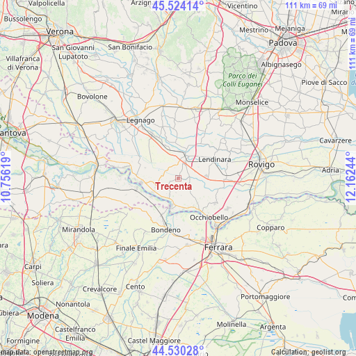
Trecenta GPS coordinates[2]
45° 1' 45.732" North, 11° 27' 33.516" East
| Map corner | latitude | longitude |
|---|---|---|
| Upper-left | 45.52414°, | 10.75619° |
| Center: | 45.02937°, | 11.45931° |
| Lower-right: | 44.53028°, | 12.16244° |
| Map W x H: | 110.5×110.5 km | = 68.7×68.7mi |
| max Lat: | 47.04031° ⇑39.3% North |
| Trecenta: | 45.02937° |
| min Lat: | ⇓60.7% South 35.50142° |
| min Long | Trecenta | max Long |
| 6.69888° | 11.45931° | 18.48682° |
| W 49%⇐ | ⇒51% E |
Elevation
Elevation of Trecenta is 10 m = 33 ft, and this is 296.7 m = 973 ft below average elevation for this country.
| Max E: |
2085 m = 6841 ft | 94.1% |
| Avg. | 306.7 m = 1006 ft | |
| Trecenta | 10 m = 33 ft | |
Min E: |
-4 m = -13 ft | 5.9% |
See also: Italy elevation on elevation.city.
Geographical zone
Trecenta is located in North temperate zone (between Tropic of Cancer and the Arctic Circle). Distance of this North polar circle is 2394.4 km =1487.8 mi to North.| Distance of | km | miles | from Trecenta |
|---|---|---|---|
| North Pole | 5000.3 | 3107 | to North |
| Arctic Circle | 2394.4 | 1487.8 | to North |
| Tropic Cancer | 2400.9 | 1491.8 | to South |
| Equator | 5006.8 | 3111.1 | to South |


Nearby cities:
15 places around Trecenta: (largest is in red/bold)
• Badia Polesine
7.8 km =4.8 mi,  20°
20°
• Bagnolo di Po
3.6 km =2.2 mi,  115°
115°
• Baruchella
4.1 km =2.5 mi,  352°
352°
• Calto
9 km =5.6 mi,  241°
241°
• Canda
3.5 km =2.2 mi,  77°
77°
• Castelguglielmo
6.1 km =3.8 mi,  94°
94°
• Ceneselli
7.3 km =4.5 mi,  256°
256°
• Ficarolo
8.5 km =5.3 mi,  192°
192°
• Gaiba
9.5 km =5.9 mi,  169°
169°
• Giacciano con Baruchella
4.3 km =2.7 mi, 350°
• Masi
9.1 km =5.7 mi,  14°
14°
• Menà
6.9 km =4.3 mi,  343°
343°
• Ramodipalo Rasa
9.8 km =6.1 mi,  54°
54°
• Salara
5.5 km =3.4 mi,  208°
208°
• Villa d'Adige
9.1 km =5.7 mi, 348°
Sources, notices
• [Note1] Compared only with cities in Italy existing in our database
• [Src1] Map data: © OpenStreetMap contributors (CC-BY-SA)
• [Src2] Other city data from geonames.org with taken over terms of usage.
• [Src3] Geographical zone / Annual Mean Temperature by Robert A. Rohde @ Wikipedia
