Torricella geodata
Torricella (Abruzzo) is a seat of a third-order administrative division; located in Italy in Europe/Rome (GMT+2) time zone. With population of 1,046 people, there are 6479 cities with bigger population in this country. Compared to other cities in Italy, 65.4% of cities are located further ↑North; 75.2% of cities are located further ←West and 74.4% of cities have lower elevation than Torricella. Note1
Administrative division(s):
- Level 1: Abruzzo
- Level 2: Provincia di Teramo
- Level 3: Torricella Sicura


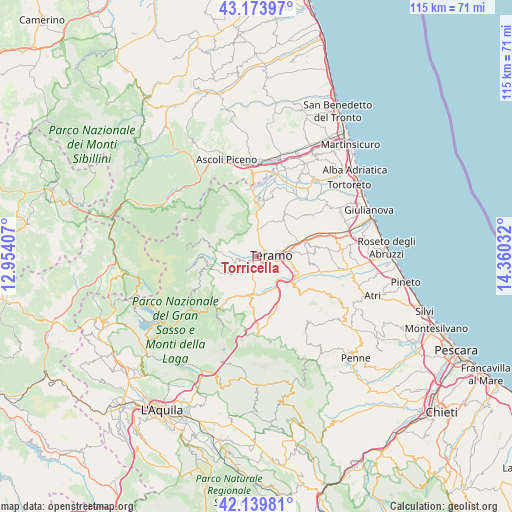
Torricella GPS coordinates[2]
42° 39' 32.544" North, 13° 39' 25.884" East
| Map corner | latitude | longitude |
|---|---|---|
| Upper-left | 43.17397°, | 12.95407° |
| Center: | 42.65904°, | 13.65719° |
| Lower-right: | 42.13981°, | 14.36032° |
| Map W x H: | 115×115 km | = 71.5×71.5mi |
| max Lat: | 47.04031° ⇑65.4% North |
| Torricella: | 42.65904° |
| min Lat: | ⇓34.6% South 35.50142° |
| min Long | Torricella | max Long |
| 6.69888° | 13.65719° | 18.48682° |
| W 75.2%⇐ | ⇒24.8% E |
Elevation
Elevation of Torricella is 444 m = 1457 ft, and this is 137.3 m = 450 ft above average elevation for this country.
| Max E: |
2085 m = 6841 ft | 25.6% |
| Torricella | 444 m 1457 ft | |
| Avg. | 306.7 m = 1006 ft | |
Min E: |
-4 m = -13 ft | 74.4% |
See also: Italy elevation on elevation.city.
Geographical zone
Torricella is located in North temperate zone (between Tropic of Cancer and the Arctic Circle). Distance of this Northern Tropic circle is 2137.3 km =1328.1 mi to South.| Distance of | km | miles | from Torricella |
|---|---|---|---|
| North Pole | 5263.8 | 3270.8 | to North |
| Arctic Circle | 2657.9 | 1651.5 | to North |
| Tropic Cancer | 2137.3 | 1328.1 | to South |
| Equator | 4743.2 | 2947.3 | to South |


Nearby cities:
15 places around Torricella: (largest is in red/bold)
• Basciano
9.5 km =5.9 mi,  137°
137°
• Campli
7.9 km =4.9 mi,  17°
17°
• Cannelli
4.9 km =3 mi,  51°
51°
• Castelnuovo
8.5 km =5.3 mi, 21°
• Colle Santa Maria-Varano
7.3 km =4.5 mi, 45°
• Colleatterrato Alto
6.4 km =4 mi,  68°
68°
• Montorio al Vomano
8.8 km =5.5 mi,  190°
190°
• Nepezzano
8.8 km =5.5 mi, 67°
• Piano d'Accio
8.7 km =5.4 mi, 71°
• Putignano
2.7 km =1.7 mi,  11°
11°
• Teramo
3.4 km =2.1 mi,  85°
85°
• Tordinia-Villa Ripa
2.9 km =1.8 mi,  180°
180°
• Val Vomano
9.9 km =6.2 mi,  124°
124°
• Valle San Giovanni
5.3 km =3.3 mi,  217°
217°
• Villa Vomano
10.1 km =6.3 mi, 120°
In other languages:
- In France: Torricella Sicura
- In German: Torricella Sicura
- In Italian: Torricella Sicura
Sources, notices
• [Note1] Compared only with cities in Italy existing in our database
• [Src1] Map data: © OpenStreetMap contributors (CC-BY-SA)
• [Src2] Other city data from geonames.org with taken over terms of usage.
• [Src3] Geographical zone / Annual Mean Temperature by Robert A. Rohde @ Wikipedia
