Tegoleto geodata
Tegoleto (Tuscany) is a populated place; located in Italy in Europe/Rome (GMT+2) time zone. With population of 1,373 people, there are 5428 cities with bigger population in this country. Compared to other cities in Italy, 60.6% of cities are located further ↑North; 52.9% of cities are located further ←West and 53.8% of cities have lower elevation than Tegoleto. Note1
Administrative division(s):
- Level 1: Tuscany
- Level 2: Province of Arezzo
- Level 3: Civitella in Val di Chiana


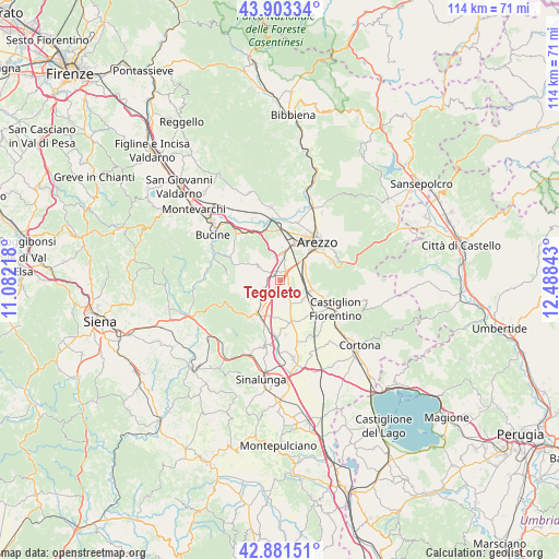
Tegoleto GPS coordinates[2]
43° 23' 40.488" North, 11° 47' 7.08" East
| Map corner | latitude | longitude |
|---|---|---|
| Upper-left | 43.90334°, | 11.08218° |
| Center: | 43.39458°, | 11.7853° |
| Lower-right: | 42.88151°, | 12.48843° |
| Map W x H: | 113.6×113.6 km | = 70.6×70.6mi |
| max Lat: | 47.04031° ⇑60.6% North |
| Tegoleto: | 43.39458° |
| min Lat: | ⇓39.4% South 35.50142° |
| min Long | Tegoleto | max Long |
| 6.69888° | 11.7853° | 18.48682° |
| W 52.9%⇐ | ⇒47.1% E |
Elevation
Elevation of Tegoleto is 258 m = 846 ft, and this is 48.7 m = 160 ft below average elevation for this country.
| Max E: |
2085 m = 6841 ft | 46.2% |
| Avg. | 306.7 m = 1006 ft | |
| Tegoleto | 258 m = 846 ft | |
Min E: |
-4 m = -13 ft | 53.8% |
See also: Italy elevation on elevation.city.
Geographical zone
Tegoleto is located in North temperate zone (between Tropic of Cancer and the Arctic Circle). Distance of this Northern Tropic circle is 2219.1 km =1378.9 mi to South.| Distance of | km | miles | from Tegoleto |
|---|---|---|---|
| North Pole | 5182 | 3219.9 | to North |
| Arctic Circle | 2576.1 | 1600.7 | to North |
| Tropic Cancer | 2219.1 | 1378.9 | to South |
| Equator | 4825 | 2998.1 | to South |


Nearby cities:
15 places around Tegoleto: (largest is in red/bold)
• Alberoro
3.6 km =2.2 mi,  149°
149°
• Arezzo
10.8 km =6.7 mi,  45°
45°
• Badia al Pino
1.5 km =0.9 mi,  315°
315°
• Battifolle-Ruscello-Poggiola
6.3 km =3.9 mi,  10°
10°
• Cesa
9 km =5.6 mi,  165°
165°
• Ciggiano
6.7 km =4.2 mi,  240°
240°
• Civitella in Val di Chiana
5.6 km =3.5 mi,  296°
296°
• Marciano
9.8 km =6.1 mi,  176°
176°
• Marciano della Chiana
10 km =6.2 mi, 179°
• Montagnano
6 km =3.7 mi,  160°
160°
• Monte San Savino
8.4 km =5.2 mi,  214°
214°
• Pieve al Toppo
1.7 km =1.1 mi,  32°
32°
• Ponticino
11 km =6.8 mi,  329°
329°
• Pratantico-Indicatore
9.7 km =6 mi, 9°
• Viciomaggio
4.3 km =2.7 mi,  346°
346°
Sources, notices
• [Note1] Compared only with cities in Italy existing in our database
• [Src1] Map data: © OpenStreetMap contributors (CC-BY-SA)
• [Src2] Other city data from geonames.org with taken over terms of usage.
• [Src3] Geographical zone / Annual Mean Temperature by Robert A. Rohde @ Wikipedia
