Battifolle-Ruscello-Poggiola geodata
Battifolle-Ruscello-Poggiola (Tuscany) is a populated place; located in Italy in Europe/Rome (GMT+2) time zone. With population of 2,676 people, there are 3337 cities with bigger population in this country. Compared to other cities in Italy, 60.3% of cities are located further ↑North; 53.1% of cities are located further ←West and 52.5% of cities have lower elevation than Battifolle-Ruscello-Poggiola. Note1
Current local time in Battifolle-Ruscello-Poggiola:
01:51 PM, WednesdayDifference from your time zone: hours


Battifolle-Ruscello-Poggiola GPS coordinates[2]
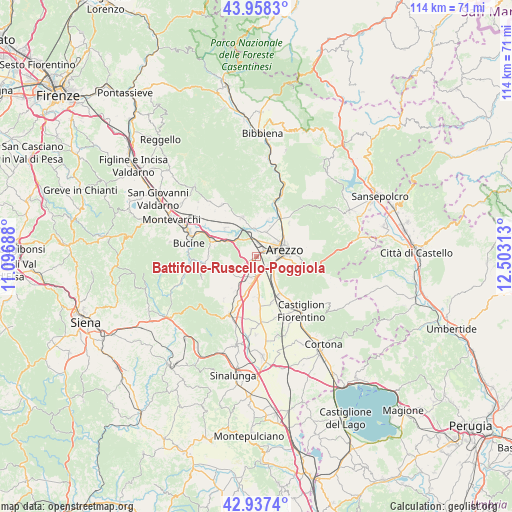
43° 27' 0" North, 11° 48' 0" East
| Map corner | latitude | longitude |
|---|---|---|
| Upper-left | 43.9583°, | 11.09688° |
| Center: | 43.45°, | 11.8° |
| Lower-right: | 42.9374°, | 12.50313° |
| Map W x H: | 113.5×113.5 km | = 70.5×70.5mi |
| max Lat: | 47.04031° ⇑60.3% North |
| Battifolle-Ruscello-Poggiola: | 43.45° |
| min Lat: | ⇓39.7% South 35.50142° |
| min Long | Battifolle-Rusc | max Long |
| 6.69888° | 11.8° | 18.48682° |
| W 53.1%⇐ | ⇒46.9% E |
Elevation
Elevation of Battifolle-Ruscello-Poggiola is 250 m = 820 ft, and this is 56.7 m = 186 ft below average elevation for this country.
| Max E: |
2085 m = 6841 ft | 47.5% |
| Avg. | 306.7 m = 1006 ft | |
| Battifolle-Ruscello-Poggiola | 250 m = 820 ft | |
Min E: |
-4 m = -13 ft | 52.5% |
See also: Italy elevation on elevation.city.
Geographical zone
Battifolle-Ruscello-Poggiola is located in North temperate zone (between Tropic of Cancer and the Arctic Circle). Distance of this Northern Tropic circle is 2225.3 km =1382.7 mi to South.| Distance of | km | miles | from Battifolle-Ruscello-Poggiola |
|---|---|---|---|
| North Pole | 5175.9 | 3216.2 | to North |
| Arctic Circle | 2570 | 1596.9 | to North |
| Tropic Cancer | 2225.3 | 1382.7 | to South |
| Equator | 4831.2 | 3002 | to South |


Nearby cities:
15 places around Battifolle-Ruscello-Poggiola: (largest is in red/bold)
• Alberoro
9.3 km =5.8 mi,  176°
176°
• Arezzo
6.7 km =4.2 mi,  77°
77°
• Badia al Pino
5.6 km =3.5 mi,  203°
203°
• Castelluccio
8.6 km =5.3 mi,  18°
18°
• Castiglion Fibocchi
9.2 km =5.7 mi,  340°
340°
• Cavi-Casalone
8.1 km =5 mi,  294°
294°
• Civitella in Val di Chiana
7.2 km =4.5 mi,  239°
239°
• Laterina
8.8 km =5.5 mi,  310°
310°
• Pergine Valdarno
9.5 km =5.9 mi,  283°
283°
• Pieve al Toppo
4.7 km =2.9 mi, 183°
• Ponticino
7.5 km =4.7 mi,  296°
296°
• Pratantico-Indicatore
3.4 km =2.1 mi,  7°
7°
• Quarata
5.8 km =3.6 mi, 22°
• Tegoleto
6.3 km =3.9 mi,  190°
190°
• Viciomaggio
2.9 km =1.8 mi,  227°
227°
Sources, notices
• [Note1] Compared only with cities in Italy existing in our database
• [Src1] Map data: © OpenStreetMap contributors (CC-BY-SA)
• [Src2] Other city data from geonames.org with taken over terms of usage.
• [Src3] Geographical zone / Annual Mean Temperature by Robert A. Rohde @ Wikipedia
