Pratantico-Indicatore geodata
Pratantico-Indicatore (Tuscany) is a populated place; located in Italy in Europe/Rome (GMT+2) time zone. With population of 3,067 people, there are 2985 cities with bigger population in this country. Compared to other cities in Italy, 60% of cities are located further ↑North; 53.2% of cities are located further ←West and 53.4% of cities have lower elevation than Pratantico-Indicatore. Note1
Current local time in Pratantico-Indicatore:
12:47 PM, WednesdayDifference from your time zone: hours


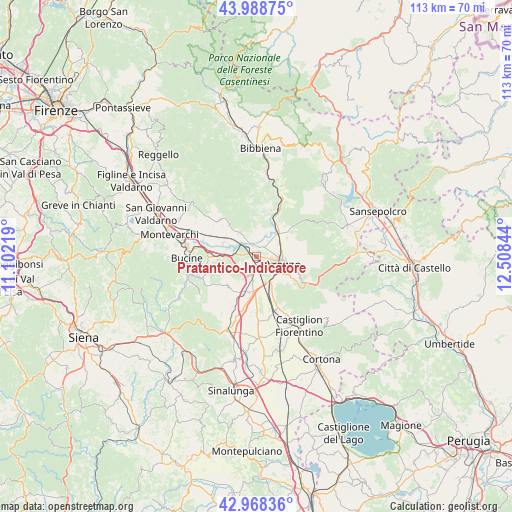
Pratantico-Indicatore GPS coordinates[2]
43° 28' 50.556" North, 11° 48' 19.116" East
| Map corner | latitude | longitude |
|---|---|---|
| Upper-left | 43.98875°, | 11.10219° |
| Center: | 43.48071°, | 11.80531° |
| Lower-right: | 42.96836°, | 12.50844° |
| Map W x H: | 113.5×113.5 km | = 70.5×70.5mi |
| max Lat: | 47.04031° ⇑60% North |
| Pratantico-Indicatore: | 43.48071° |
| min Lat: | ⇓40% South 35.50142° |
| min Long | Pratantico-Indi | max Long |
| 6.69888° | 11.80531° | 18.48682° |
| W 53.2%⇐ | ⇒46.8% E |
Elevation
Elevation of Pratantico-Indicatore is 255 m = 837 ft, and this is 51.7 m = 170 ft below average elevation for this country.
| Max E: |
2085 m = 6841 ft | 46.6% |
| Avg. | 306.7 m = 1006 ft | |
| Pratantico-Indicatore | 255 m = 837 ft | |
Min E: |
-4 m = -13 ft | 53.4% |
See also: Italy elevation on elevation.city.
Geographical zone
Pratantico-Indicatore is located in North temperate zone (between Tropic of Cancer and the Arctic Circle). Distance of this Northern Tropic circle is 2228.7 km =1384.8 mi to South.| Distance of | km | miles | from Pratantico-Indicatore |
|---|---|---|---|
| North Pole | 5172.5 | 3214 | to North |
| Arctic Circle | 2566.6 | 1594.8 | to North |
| Tropic Cancer | 2228.7 | 1384.8 | to South |
| Equator | 4834.6 | 3004.1 | to South |


Nearby cities:
15 places around Pratantico-Indicatore: (largest is in red/bold)
• Arezzo
6.4 km =4 mi,  108°
108°
• Badia al Pino
8.9 km =5.5 mi,  197°
197°
• Battifolle-Ruscello-Poggiola
3.4 km =2.1 mi,  187°
187°
• Castelluccio
5.2 km =3.2 mi,  25°
25°
• Castiglion Fibocchi
6.3 km =3.9 mi,  325°
325°
• Cavi-Casalone
7.8 km =4.8 mi,  269°
269°
• Chiassa-Tregozzano
7.8 km =4.8 mi,  62°
62°
• Civitella in Val di Chiana
9.7 km =6 mi,  223°
223°
• Giovi-Ponte alla Chiassa
7 km =4.3 mi,  43°
43°
• Laterina
7.5 km =4.7 mi,  288°
288°
• Pieve al Toppo
8.2 km =5.1 mi,  184°
184°
• Ponticino
7.2 km =4.5 mi, 269°
• Quarata
2.7 km =1.7 mi, 41°
• Tegoleto
9.7 km =6 mi, 189°
• Viciomaggio
6 km =3.7 mi,  205°
205°
Sources, notices
• [Note1] Compared only with cities in Italy existing in our database
• [Src1] Map data: © OpenStreetMap contributors (CC-BY-SA)
• [Src2] Other city data from geonames.org with taken over terms of usage.
• [Src3] Geographical zone / Annual Mean Temperature by Robert A. Rohde @ Wikipedia
