Marciano geodata
Marciano (Tuscany) is a seat of a third-order administrative division; located in Italy in Europe/Rome (GMT+2) time zone. With population of 890 people, there are 7207 cities with bigger population in this country. Compared to other cities in Italy, 61.1% of cities are located further ↑North; 53% of cities are located further ←West and 60.2% of cities have lower elevation than Marciano. Note1
Administrative division(s):
- Level 1: Tuscany
- Level 2: Province of Arezzo
- Level 3: Marciano della Chiana


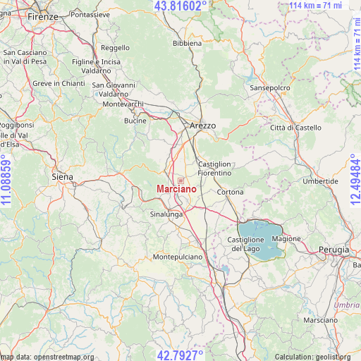
Marciano GPS coordinates[2]
43° 18' 23.436" North, 11° 47' 30.156" East
| Map corner | latitude | longitude |
|---|---|---|
| Upper-left | 43.81602°, | 11.08859° |
| Center: | 43.30651°, | 11.79171° |
| Lower-right: | 42.7927°, | 12.49484° |
| Map W x H: | 113.8×113.8 km | = 70.7×70.7mi |
| max Lat: | 47.04031° ⇑61.1% North |
| Marciano: | 43.30651° |
| min Lat: | ⇓38.9% South 35.50142° |
| min Long | Marciano | max Long |
| 6.69888° | 11.79171° | 18.48682° |
| W 53%⇐ | ⇒47% E |
Elevation
Elevation of Marciano is 300 m = 984 ft, and this is 6.7 m = 22 ft below average elevation for this country.
| Max E: |
2085 m = 6841 ft | 39.8% |
| Avg. | 306.7 m = 1006 ft | |
| Marciano | 300 m = 984 ft | |
Min E: |
-4 m = -13 ft | 60.2% |
See also: Italy elevation on elevation.city.
Geographical zone
Marciano is located in North temperate zone (between Tropic of Cancer and the Arctic Circle). Distance of this Northern Tropic circle is 2209.3 km =1372.8 mi to South.| Distance of | km | miles | from Marciano |
|---|---|---|---|
| North Pole | 5191.8 | 3226 | to North |
| Arctic Circle | 2585.9 | 1606.8 | to North |
| Tropic Cancer | 2209.3 | 1372.8 | to South |
| Equator | 4815.2 | 2992 | to South |


Nearby cities:
15 places around Marciano: (largest is in red/bold)
• Alberoro
6.8 km =4.2 mi,  10°
10°
• Badia al Pino
11 km =6.8 mi,  351°
351°
• Castiglion Fiorentino
11.1 km =6.9 mi,  68°
68°
• Cesa
2 km =1.2 mi,  57°
57°
• Ciggiano
9.1 km =5.7 mi,  315°
315°
• Foiano della Chiana
6.3 km =3.9 mi,  161°
161°
• Guazzino
10.5 km =6.5 mi,  184°
184°
• Lucignano
5.3 km =3.3 mi,  224°
224°
• Marciano della Chiana
0.5 km =0.3 mi,  247°
247°
• Montagnano
4.4 km =2.7 mi,  19°
19°
• Monte San Savino
6 km =3.7 mi,  298°
298°
• Montecchio
10.9 km =6.8 mi,  86°
86°
• Pozzo della Chiana
1.7 km =1.1 mi, 156°
• Sinalunga
10.9 km =6.8 mi,  200°
200°
• Tegoleto
9.8 km =6.1 mi,  356°
356°
Sources, notices
• [Note1] Compared only with cities in Italy existing in our database
• [Src1] Map data: © OpenStreetMap contributors (CC-BY-SA)
• [Src2] Other city data from geonames.org with taken over terms of usage.
• [Src3] Geographical zone / Annual Mean Temperature by Robert A. Rohde @ Wikipedia
