Badia al Pino geodata
Badia al Pino (Tuscany) is a seat of a third-order administrative division; located in Italy in Europe/Rome (GMT+2) time zone. With population of 1,127 people, there are 6183 cities with bigger population in this country. Compared to other cities in Italy, 60.5% of cities are located further ↑North; 52.7% of cities are located further ←West and 55.4% of cities have lower elevation than Badia al Pino. Note1
Administrative division(s):
- Level 1: Tuscany
- Level 2: Province of Arezzo
- Level 3: Civitella in Val di Chiana


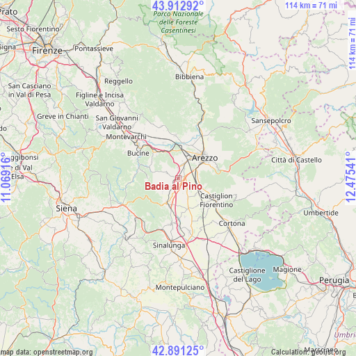
Badia al Pino GPS coordinates[2]
43° 24' 15.264" North, 11° 46' 20.208" East
| Map corner | latitude | longitude |
|---|---|---|
| Upper-left | 43.91292°, | 11.06916° |
| Center: | 43.40424°, | 11.77228° |
| Lower-right: | 42.89125°, | 12.47541° |
| Map W x H: | 113.6×113.6 km | = 70.6×70.6mi |
| max Lat: | 47.04031° ⇑60.5% North |
| Badia al Pino: | 43.40424° |
| min Lat: | ⇓39.5% South 35.50142° |
| min Long | Badia al Pino | max Long |
| 6.69888° | 11.77228° | 18.48682° |
| W 52.7%⇐ | ⇒47.3% E |
Elevation
Elevation of Badia al Pino is 268 m = 879 ft, and this is 38.7 m = 127 ft below average elevation for this country.
| Max E: |
2085 m = 6841 ft | 44.6% |
| Avg. | 306.7 m = 1006 ft | |
| Badia al Pino | 268 m = 879 ft | |
Min E: |
-4 m = -13 ft | 55.4% |
See also: Italy elevation on elevation.city.
Geographical zone
Badia al Pino is located in North temperate zone (between Tropic of Cancer and the Arctic Circle). Distance of this Northern Tropic circle is 2220.2 km =1379.6 mi to South.| Distance of | km | miles | from Badia al Pino |
|---|---|---|---|
| North Pole | 5181 | 3219.3 | to North |
| Arctic Circle | 2575.1 | 1600.1 | to North |
| Tropic Cancer | 2220.2 | 1379.6 | to South |
| Equator | 4826.1 | 2998.8 | to South |


Nearby cities:
15 places around Badia al Pino: (largest is in red/bold)
• Alberoro
5 km =3.1 mi,  145°
145°
• Badia Agnano
10.5 km =6.5 mi,  289°
289°
• Battifolle-Ruscello-Poggiola
5.6 km =3.5 mi,  23°
23°
• Cavi-Casalone
9.8 km =6.1 mi,  328°
328°
• Cesa
10.3 km =6.4 mi,  161°
161°
• Ciggiano
6.5 km =4 mi,  227°
227°
• Civitella in Val di Chiana
4.2 km =2.6 mi, 290°
• Montagnano
7.4 km =4.6 mi, 155°
• Monte San Savino
8.8 km =5.5 mi,  204°
204°
• Pergine Valdarno
10.1 km =6.3 mi,  316°
316°
• Pieve al Toppo
2 km =1.2 mi,  79°
79°
• Ponticino
9.6 km =6 mi, 331°
• Pratantico-Indicatore
8.9 km =5.5 mi, 17°
• Tegoleto
1.5 km =0.9 mi,  135°
135°
• Viciomaggio
3.1 km =1.9 mi,  1°
1°
Sources, notices
• [Note1] Compared only with cities in Italy existing in our database
• [Src1] Map data: © OpenStreetMap contributors (CC-BY-SA)
• [Src2] Other city data from geonames.org with taken over terms of usage.
• [Src3] Geographical zone / Annual Mean Temperature by Robert A. Rohde @ Wikipedia
