Tavernola Bergamasca geodata
Tavernola Bergamasca (Lombardy) is a seat of a third-order administrative division; located in Italy in Europe/Rome (GMT+2) time zone. With population of 1,971 people, there are 4209 cities with bigger population in this country. Compared to other cities in Italy, 81.6% of cities are located further ↓South; 67.4% of cities are located further →East and 53.2% of cities have lower elevation than Tavernola Bergamasca. Note1
Administrative division(s):
- Level 1: Lombardy
- Level 2: Provincia di Bergamo
- Level 3: Tavernola Bergamasca
Current local time in Tavernola Bergamasca:
07:51 PM, WednesdayDifference from your time zone: hours


Tavernola Bergamasca GPS coordinates[2]
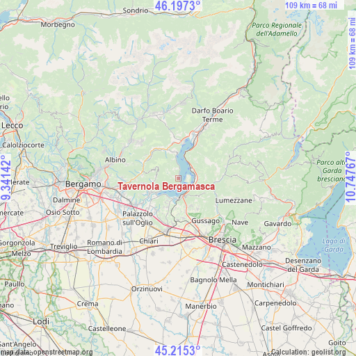
45° 42' 30.456" North, 10° 2' 40.344" East
| Map corner | latitude | longitude |
|---|---|---|
| Upper-left | 46.1973°, | 9.34142° |
| Center: | 45.70846°, | 10.04454° |
| Lower-right: | 45.2153°, | 10.74767° |
| Map W x H: | 109.2×109.2 km | = 67.9×67.9mi |
| max Lat: | 47.04031° ⇑18.4% North |
| Tavernola Bergamasca: | 45.70846° |
| min Lat: | ⇓81.6% South 35.50142° |
| min Long | Tavernola Berga | max Long |
| 6.69888° | 10.04454° | 18.48682° |
| W 32.6%⇐ | ⇒67.4% E |
Elevation
Elevation of Tavernola Bergamasca is 254 m = 833 ft, and this is 52.7 m = 173 ft below average elevation for this country.
| Max E: |
2085 m = 6841 ft | 46.8% |
| Avg. | 306.7 m = 1006 ft | |
| Tavernola Bergamasca | 254 m = 833 ft | |
Min E: |
-4 m = -13 ft | 53.2% |
See also: Italy elevation on elevation.city.
Geographical zone
Tavernola Bergamasca is located in North temperate zone (between Tropic of Cancer and the Arctic Circle). Distance of this North polar circle is 2318.9 km =1440.9 mi to North.| Distance of | km | miles | from Tavernola Bergamasca |
|---|---|---|---|
| North Pole | 4924.8 | 3060.1 | to North |
| Arctic Circle | 2318.9 | 1440.9 | to North |
| Tropic Cancer | 2476.4 | 1538.8 | to South |
| Equator | 5082.3 | 3158 | to South |


Nearby cities:
15 places around Tavernola Bergamasca: (largest is in red/bold)
• Adrara San Rocco
6.7 km =4.2 mi,  276°
276°
• Clusane
6.2 km =3.9 mi,  214°
214°
• Cremignane
6.9 km =4.3 mi,  197°
197°
• Fonteno
5.9 km =3.7 mi,  340°
340°
• Iseo
5.5 km =3.4 mi,  175°
175°
• Marone
5.1 km =3.2 mi,  51°
51°
• Parzanica
3.4 km =2.1 mi,  347°
347°
• Pilzone
4.8 km =3 mi,  143°
143°
• Predore
3.9 km =2.4 mi,  218°
218°
• Riva di Solto
7.3 km =4.5 mi,  356°
356°
• Sale Marasino
5.3 km =3.3 mi,  92°
92°
• Siviano
2.9 km =1.8 mi,  75°
75°
• Sulzano
4.9 km =3 mi,  118°
118°
• Viadanica
7 km =4.3 mi,  247°
247°
• Vigolo
1.7 km =1.1 mi,  302°
302°
Sources, notices
• [Note1] Compared only with cities in Italy existing in our database
• [Src1] Map data: © OpenStreetMap contributors (CC-BY-SA)
• [Src2] Other city data from geonames.org with taken over terms of usage.
• [Src3] Geographical zone / Annual Mean Temperature by Robert A. Rohde @ Wikipedia
