Spoleto geodata
Spoleto (Umbria) is a seat of a third-order administrative division; located in Italy in Europe/Rome (GMT+2) time zone. With population of 19,266 people, there are 454 cities with bigger population in this country. Compared to other cities in Italy, 65% of cities are located further ↑North; 65.5% of cities are located further ←West and 63.3% of cities have lower elevation than Spoleto. Note1


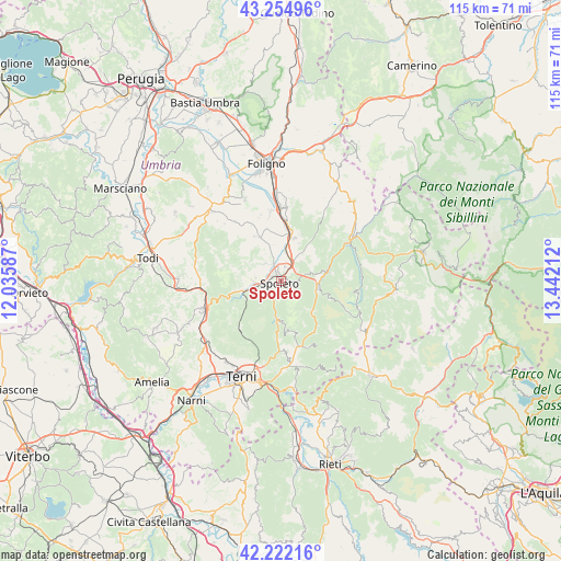
Spoleto GPS coordinates[2]
42° 44' 26.556" North, 12° 44' 20.364" East
| Map corner | latitude | longitude |
|---|---|---|
| Upper-left | 43.25496°, | 12.03587° |
| Center: | 42.74071°, | 12.73899° |
| Lower-right: | 42.22216°, | 13.44212° |
| Map W x H: | 114.8×114.8 km | = 71.3×71.3mi |
| max Lat: | 47.04031° ⇑65% North |
| Spoleto: | 42.74071° |
| min Lat: | ⇓35% South 35.50142° |
| min Long | Spoleto | max Long |
| 6.69888° | 12.73899° | 18.48682° |
| W 65.5%⇐ | ⇒34.5% E |
Elevation
Elevation of Spoleto is 326 m = 1070 ft, and this is 19.3 m = 63 ft above average elevation for this country.
| Max E: |
2085 m = 6841 ft | 36.7% |
| Spoleto | 326 m 1070 ft | |
| Avg. | 306.7 m = 1006 ft | |
Min E: |
-4 m = -13 ft | 63.3% |
See also: Italy elevation on elevation.city.
Geographical zone
Spoleto is located in North temperate zone (between Tropic of Cancer and the Arctic Circle). Distance of this Northern Tropic circle is 2146.4 km =1333.7 mi to South.| Distance of | km | miles | from Spoleto |
|---|---|---|---|
| North Pole | 5254.7 | 3265.1 | to North |
| Arctic Circle | 2648.9 | 1645.9 | to North |
| Tropic Cancer | 2146.4 | 1333.7 | to South |
| Equator | 4752.3 | 2952.9 | to South |


Nearby cities:
15 places around Spoleto: (largest is in red/bold)
• Bruna
9.8 km =6.1 mi,  335°
335°
• Campello sul Clitunno
9.9 km =6.2 mi,  14°
14°
• Cannaiola
13.9 km =8.6 mi,  351°
351°
• Castel Ritaldi
10.5 km =6.5 mi,  329°
329°
• Corciano-Pigge
12.2 km =7.6 mi,  4°
4°
• Cortaccione
3 km =1.9 mi,  32°
32°
• Ferentillo
14 km =8.7 mi,  163°
163°
• Meggiano
10.3 km =6.4 mi,  81°
81°
• Montefranco
16 km =9.9 mi,  172°
172°
• Poggiodomo
16.1 km =10 mi,  101°
101°
• San Giacomo
6 km =3.7 mi, 10°
• San Martino in Trignano
5.8 km =3.6 mi,  270°
270°
• Sant'Anatolia di Narco
7.9 km =4.9 mi, 96°
• Scheggino
8.1 km =5 mi,  112°
112°
• Trevi
15.3 km =9.5 mi, 3°
Sources, notices
• [Note1] Compared only with cities in Italy existing in our database
• [Src1] Map data: © OpenStreetMap contributors (CC-BY-SA)
• [Src2] Other city data from geonames.org with taken over terms of usage.
• [Src3] Geographical zone / Annual Mean Temperature by Robert A. Rohde @ Wikipedia
