Trevi geodata
Trevi (Umbria) is a seat of a third-order administrative division; located in Italy in Europe/Rome (GMT+2) time zone. With population of 4,906 people, there are 1988 cities with bigger population in this country. Compared to other cities in Italy, 64.1% of cities are located further ↑North; 65.6% of cities are located further ←West and 71.5% of cities have lower elevation than Trevi. Note1


Trevi GPS coordinates[2]
42° 52' 39.684" North, 12° 44' 57.768" East
| Map corner | latitude | longitude |
|---|---|---|
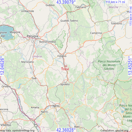
| Upper-left | 43.39079°, | 12.04626° |
| Center: | 42.87769°, | 12.74938° |
| Lower-right: | 42.36028°, | 13.45251° |
| Map W x H: | 114.6×114.6 km | = 71.2×71.2mi |
| max Lat: | 47.04031° ⇑64.1% North |
| Trevi: | 42.87769° |
| min Lat: | ⇓35.9% South 35.50142° |
| min Long | Trevi | max Long |
| 6.69888° | 12.74938° | 18.48682° |
| W 65.6%⇐ | ⇒34.4% E |
Elevation
Elevation of Trevi is 410 m = 1345 ft, and this is 103.3 m = 339 ft above average elevation for this country.
| Max E: |
2085 m = 6841 ft | 28.5% |
| Trevi | 410 m 1345 ft | |
| Avg. | 306.7 m = 1006 ft | |
Min E: |
-4 m = -13 ft | 71.5% |
See also: Italy elevation on elevation.city.
Geographical zone
Trevi is located in North temperate zone (between Tropic of Cancer and the Arctic Circle). Distance of this Northern Tropic circle is 2161.6 km =1343.2 mi to South.| Distance of | km | miles | from Trevi |
|---|---|---|---|
| North Pole | 5239.5 | 3255.7 | to North |
| Arctic Circle | 2633.6 | 1636.4 | to North |
| Tropic Cancer | 2161.6 | 1343.2 | to South |
| Equator | 4767.6 | 2962.4 | to South |


Nearby cities:
15 places around Trevi: (largest is in red/bold)
• Bevagna
12.8 km =8 mi,  301°
301°
• Bruna
8 km =5 mi,  218°
218°
• Campello sul Clitunno
5.9 km =3.7 mi,  163°
163°
• Cannaiola
3.2 km =2 mi,  243°
243°
• Castel Ritaldi
8.7 km =5.4 mi, 224°
• Corciano-Pigge
3.1 km =1.9 mi,  179°
179°
• Cortaccione
12.7 km =7.9 mi, 176°
• Fiamenga
11.1 km =6.9 mi,  319°
319°
• Foligno
9.4 km =5.8 mi,  336°
336°
• Maceratola
10.3 km =6.4 mi, 321°
• Montefalco
8.4 km =5.2 mi,  280°
280°
• San Giacomo
9.3 km =5.8 mi, 178°
• Santa Maria in Valle
1.7 km =1.1 mi,  0°
0°
• Sellano
14.2 km =8.8 mi,  85°
85°
• Spello
14.4 km =8.9 mi,  332°
332°
Sources, notices
• [Note1] Compared only with cities in Italy existing in our database
• [Src1] Map data: © OpenStreetMap contributors (CC-BY-SA)
• [Src2] Other city data from geonames.org with taken over terms of usage.
• [Src3] Geographical zone / Annual Mean Temperature by Robert A. Rohde @ Wikipedia
