Senigallia geodata
Senigallia (The Marches) is a seat of a third-order administrative division; located in Italy in Europe/Rome (GMT+2) time zone. With population of 30,882 people, there are 263 cities with bigger population in this country. Compared to other cities in Italy, 57.9% of cities are located further ↑North; 70.4% of cities are located further ←West and 96.6% of cities have higher elevation than Senigallia. Note1


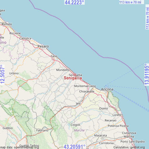
Senigallia GPS coordinates[2]
43° 42' 58.536" North, 13° 12' 31.752" East
| Map corner | latitude | longitude |
|---|---|---|
| Upper-left | 44.2223°, | 12.5057° |
| Center: | 43.71626°, | 13.20882° |
| Lower-right: | 43.20591°, | 13.91195° |
| Map W x H: | 113×113 km | = 70.2×70.2mi |
| max Lat: | 47.04031° ⇑57.9% North |
| Senigallia: | 43.71626° |
| min Lat: | ⇓42.1% South 35.50142° |
| min Long | Senigallia | max Long |
| 6.69888° | 13.20882° | 18.48682° |
| W 70.4%⇐ | ⇒29.6% E |
Elevation
Elevation of Senigallia is 6 m = 20 ft, and this is 300.7 m = 987 ft below average elevation for this country.
| Max E: |
2085 m = 6841 ft | 96.6% |
| Avg. | 306.7 m = 1006 ft | |
| Senigallia | 6 m = 20 ft | |
Min E: |
-4 m = -13 ft | 3.4% |
See also: Italy elevation on elevation.city.
Geographical zone
Senigallia is located in North temperate zone (between Tropic of Cancer and the Arctic Circle). Distance of this Northern Tropic circle is 2254.9 km =1401.1 mi to South.| Distance of | km | miles | from Senigallia |
|---|---|---|---|
| North Pole | 5146.3 | 3197.8 | to North |
| Arctic Circle | 2540.4 | 1578.5 | to North |
| Tropic Cancer | 2254.9 | 1401.1 | to South |
| Equator | 4860.8 | 3020.4 | to South |


Nearby cities:
15 places around Senigallia: (largest is in red/bold)
• Casine
10.7 km =6.6 mi,  208°
208°
• Castelvecchio
12.2 km =7.6 mi,  260°
260°
• Marina di Montemarciano
12.6 km =7.8 mi,  125°
125°
• Marotta
7.2 km =4.5 mi,  317°
317°
• Mondolfo
9.1 km =5.7 mi,  290°
290°
• Montemarciano
11.8 km =7.3 mi,  137°
137°
• Monterado
9.7 km =6 mi, 257°
• Montignano-Marzocca
8.1 km =5 mi, 125°
• Ostra
11.8 km =7.3 mi,  199°
199°
• Passo Ripe
9.7 km =6 mi,  226°
226°
• Pianello
11.8 km =7.3 mi, 212°
• Ripe
9.8 km =6.1 mi,  237°
237°
• San Costanzo
12.3 km =7.6 mi,  297°
297°
• Sant'Angelo
4.5 km =2.8 mi,  172°
172°
• Vallone
4.4 km =2.7 mi, 202°
Sources, notices
• [Note1] Compared only with cities in Italy existing in our database
• [Src1] Map data: © OpenStreetMap contributors (CC-BY-SA)
• [Src2] Other city data from geonames.org with taken over terms of usage.
• [Src3] Geographical zone / Annual Mean Temperature by Robert A. Rohde @ Wikipedia
