Senerchia geodata
Senerchia (Campania) is a seat of a third-order administrative division; located in Italy in Europe/Rome (GMT+2) time zone. With population of 548 people, there are 9471 cities with bigger population in this country. Compared to other cities in Italy, 82% of cities are located further ↑North; 88.9% of cities are located further ←West and 84.4% of cities have lower elevation than Senerchia. Note1


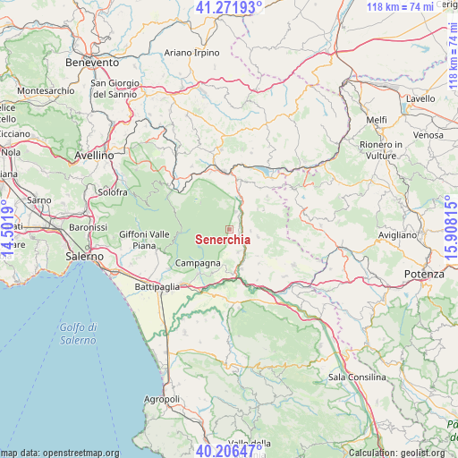
Senerchia GPS coordinates[2]
40° 44' 28.788" North, 15° 12' 18.072" East
| Map corner | latitude | longitude |
|---|---|---|
| Upper-left | 41.27193°, | 14.5019° |
| Center: | 40.74133°, | 15.20502° |
| Lower-right: | 40.20647°, | 15.90815° |
| Map W x H: | 118.5×118.5 km | = 73.6×73.6mi |
| max Lat: | 47.04031° ⇑82% North |
| Senerchia: | 40.74133° |
| min Lat: | ⇓18% South 35.50142° |
| min Long | Senerchia | max Long |
| 6.69888° | 15.20502° | 18.48682° |
| W 88.9%⇐ | ⇒11.1% E |
Elevation
Elevation of Senerchia is 598 m = 1962 ft, and this is 291.3 m = 956 ft above average elevation for this country.
| Max E: |
2085 m = 6841 ft | 15.6% |
| Senerchia | 598 m 1962 ft | |
| Avg. | 306.7 m = 1006 ft | |
Min E: |
-4 m = -13 ft | 84.4% |
See also: Italy elevation on elevation.city.
Geographical zone
Senerchia is located in North temperate zone (between Tropic of Cancer and the Arctic Circle). Distance of this Northern Tropic circle is 1924.1 km =1195.6 mi to South.| Distance of | km | miles | from Senerchia |
|---|---|---|---|
| North Pole | 5477.1 | 3403.3 | to North |
| Arctic Circle | 2871.2 | 1784.1 | to North |
| Tropic Cancer | 1924.1 | 1195.6 | to South |
| Equator | 4530 | 2814.8 | to South |


Nearby cities:
15 places around Senerchia: (largest is in red/bold)
• Acerno
12.5 km =7.8 mi,  268°
268°
• Calabritto
4.9 km =3 mi,  17°
17°
• Campagna
11.8 km =7.3 mi,  225°
225°
• Caposele
8.4 km =5.2 mi,  10°
10°
• Colliano
7.4 km =4.6 mi,  106°
106°
• Contursi Terme
10.6 km =6.6 mi,  163°
163°
• Laviano
10 km =6.2 mi,  60°
60°
• Materdomini
8.9 km =5.5 mi, 16°
• Oliveto Citra
6.2 km =3.9 mi, 157°
• Palomonte
11.4 km =7.1 mi,  140°
140°
• Piani
8.9 km =5.5 mi, 13°
• Puglietta
11 km =6.8 mi,  203°
203°
• Santomenna
12.6 km =7.8 mi,  54°
54°
• Teora
13 km =8.1 mi, 18°
• Valva
5.3 km =3.3 mi,  93°
93°
Sources, notices
• [Note1] Compared only with cities in Italy existing in our database
• [Src1] Map data: © OpenStreetMap contributors (CC-BY-SA)
• [Src2] Other city data from geonames.org with taken over terms of usage.
• [Src3] Geographical zone / Annual Mean Temperature by Robert A. Rohde @ Wikipedia
