Sedegliano geodata
Sedegliano (Friuli Venezia Giulia) is a seat of a third-order administrative division; located in Italy in Europe/Rome (GMT+2) time zone. With population of 1,169 people, there are 6060 cities with bigger population in this country. Compared to other cities in Italy, 92.3% of cities are located further ↓South; 68% of cities are located further ←West and 75.9% of cities have higher elevation than Sedegliano. Note1
Administrative division(s):
- Level 1: Friuli Venezia Giulia
- Level 2: Provincia di Udine
- Level 3: Sedegliano


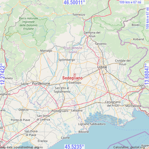
Sedegliano GPS coordinates[2]
46° 0' 50.256" North, 12° 58' 38.424" East
| Map corner | latitude | longitude |
|---|---|---|
| Upper-left | 46.50011°, | 12.27422° |
| Center: | 46.01396°, | 12.97734° |
| Lower-right: | 45.5235°, | 13.68047° |
| Map W x H: | 108.6×108.6 km | = 67.5×67.5mi |
| max Lat: | 47.04031° ⇑7.7% North |
| Sedegliano: | 46.01396° |
| min Lat: | ⇓92.3% South 35.50142° |
| min Long | Sedegliano | max Long |
| 6.69888° | 12.97734° | 18.48682° |
| W 68%⇐ | ⇒32% E |
Elevation
Elevation of Sedegliano is 70 m = 230 ft, and this is 236.7 m = 777 ft below average elevation for this country.
| Max E: |
2085 m = 6841 ft | 75.9% |
| Avg. | 306.7 m = 1006 ft | |
| Sedegliano | 70 m = 230 ft | |
Min E: |
-4 m = -13 ft | 24.1% |
See also: Italy elevation on elevation.city.
Geographical zone
Sedegliano is located in North temperate zone (between Tropic of Cancer and the Arctic Circle). Distance of this North polar circle is 2284.9 km =1419.8 mi to North.| Distance of | km | miles | from Sedegliano |
|---|---|---|---|
| North Pole | 4890.8 | 3039 | to North |
| Arctic Circle | 2284.9 | 1419.8 | to North |
| Tropic Cancer | 2510.4 | 1559.9 | to South |
| Equator | 5116.3 | 3179.1 | to South |


Nearby cities:
15 places around Sedegliano: (largest is in red/bold)
• Basiliano
7.2 km =4.5 mi,  89°
89°
• Basiliano-Vissandone
9 km =5.6 mi,  83°
83°
• Biauzzo
7.7 km =4.8 mi,  208°
208°
• Cisterna
8 km =5 mi,  5°
5°
• Codroipo
5.5 km =3.4 mi,  177°
177°
• Dignano
8.3 km =5.2 mi,  339°
339°
• Flaibano
5 km =3.1 mi, 6°
• Gradisca
1.8 km =1.1 mi,  218°
218°
• Mereto di Tomba
6.6 km =4.1 mi,  51°
51°
• Pantianicco
4.6 km =2.9 mi, 76°
• Rivolto-Lonca
8.4 km =5.2 mi,  154°
154°
• San Lorenzo
2.3 km =1.4 mi,  136°
136°
• San Martino al Tagliamento
8.3 km =5.2 mi,  272°
272°
• Valvasone
8.9 km =5.5 mi,  254°
254°
• Villaorba
7.2 km =4.5 mi, 93°
Sources, notices
• [Note1] Compared only with cities in Italy existing in our database
• [Src1] Map data: © OpenStreetMap contributors (CC-BY-SA)
• [Src2] Other city data from geonames.org with taken over terms of usage.
• [Src3] Geographical zone / Annual Mean Temperature by Robert A. Rohde @ Wikipedia
