Biauzzo geodata
Biauzzo (Friuli Venezia Giulia) is a populated place; located in Italy in Europe/Rome (GMT+2) time zone. With population of 728 people, there are 8100 cities with bigger population in this country. Compared to other cities in Italy, 90.7% of cities are located further ↓South; 67.5% of cities are located further ←West and 82.2% of cities have higher elevation than Biauzzo. Note1
Administrative division(s):
- Level 1: Friuli Venezia Giulia
- Level 2: Provincia di Udine
- Level 3: Codroipo


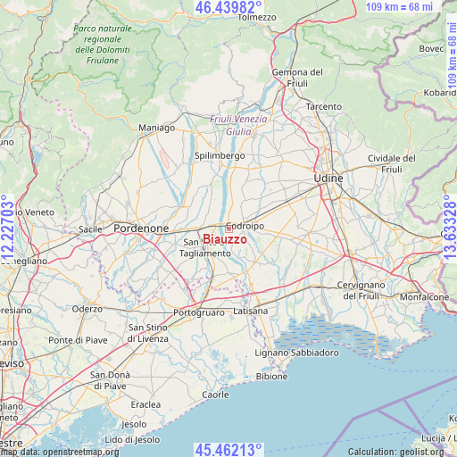
Biauzzo GPS coordinates[2]
45° 57' 11.268" North, 12° 55' 48.54" East
| Map corner | latitude | longitude |
|---|---|---|
| Upper-left | 46.43982°, | 12.22703° |
| Center: | 45.95313°, | 12.93015° |
| Lower-right: | 45.46213°, | 13.63328° |
| Map W x H: | 108.7×108.7 km | = 67.5×67.5mi |
| max Lat: | 47.04031° ⇑9.3% North |
| Biauzzo: | 45.95313° |
| min Lat: | ⇓90.7% South 35.50142° |
| min Long | Biauzzo | max Long |
| 6.69888° | 12.93015° | 18.48682° |
| W 67.5%⇐ | ⇒32.5% E |
Elevation
Elevation of Biauzzo is 41 m = 135 ft, and this is 265.7 m = 872 ft below average elevation for this country.
| Max E: |
2085 m = 6841 ft | 82.2% |
| Avg. | 306.7 m = 1006 ft | |
| Biauzzo | 41 m = 135 ft | |
Min E: |
-4 m = -13 ft | 17.8% |
See also: Italy elevation on elevation.city.
Geographical zone
Biauzzo is located in North temperate zone (between Tropic of Cancer and the Arctic Circle). Distance of this North polar circle is 2291.7 km =1424 mi to North.| Distance of | km | miles | from Biauzzo |
|---|---|---|---|
| North Pole | 4897.6 | 3043.2 | to North |
| Arctic Circle | 2291.7 | 1424 | to North |
| Tropic Cancer | 2503.6 | 1555.7 | to South |
| Equator | 5109.5 | 3174.9 | to South |


Nearby cities:
15 places around Biauzzo: (largest is in red/bold)
• Arzene
8 km =5 mi,  309°
309°
• Camino al Tagliamento
3.1 km =1.9 mi,  158°
158°
• Casarsa della Delizia
6.8 km =4.2 mi,  267°
267°
• Codroipo
4.1 km =2.5 mi,  71°
71°
• Gleris
7.7 km =4.8 mi,  213°
213°
• Gradisca
6 km =3.7 mi,  25°
25°
• Rivolto-Lonca
7.3 km =4.5 mi,  96°
96°
• Rosa
5.2 km =3.2 mi,  241°
241°
• San Lorenzo
7.3 km =4.5 mi,  45°
45°
• San Martino al Tagliamento
8.5 km =5.3 mi,  326°
326°
• San Vito al Tagliamento
6.8 km =4.2 mi,  233°
233°
• Savorgnano
8.7 km =5.4 mi,  223°
223°
• Sedegliano
7.7 km =4.8 mi, 28°
• Valvasone
6.6 km =4.1 mi, 312°
• Varmo
8.8 km =5.5 mi,  148°
148°
Sources, notices
• [Note1] Compared only with cities in Italy existing in our database
• [Src1] Map data: © OpenStreetMap contributors (CC-BY-SA)
• [Src2] Other city data from geonames.org with taken over terms of usage.
• [Src3] Geographical zone / Annual Mean Temperature by Robert A. Rohde @ Wikipedia
