Sarmeola geodata
Sarmeola (Veneto) is a populated place; located in Italy in Europe/Rome (GMT+2) time zone. With population of 7,797 people, there are 1250 cities with bigger population in this country. Compared to other cities in Italy, 71.1% of cities are located further ↓South; 53.4% of cities are located further ←West and 91.1% of cities have higher elevation than Sarmeola. Note1


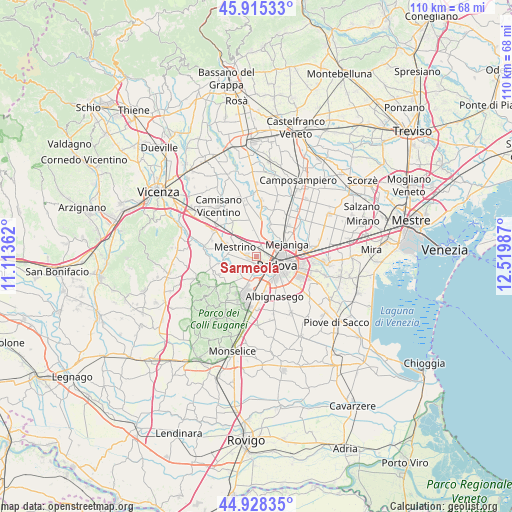
Sarmeola GPS coordinates[2]
45° 25' 26.4" North, 11° 49' 0.264" East
| Map corner | latitude | longitude |
|---|---|---|
| Upper-left | 45.91533°, | 11.11362° |
| Center: | 45.424°, | 11.81674° |
| Lower-right: | 44.92835°, | 12.51987° |
| Map W x H: | 109.7×109.7 km | = 68.2×68.2mi |
| max Lat: | 47.04031° ⇑28.9% North |
| Sarmeola: | 45.424° |
| min Lat: | ⇓71.1% South 35.50142° |
| min Long | Sarmeola | max Long |
| 6.69888° | 11.81674° | 18.48682° |
| W 53.4%⇐ | ⇒46.6% E |
Elevation
Elevation of Sarmeola is 16 m = 52 ft, and this is 290.7 m = 954 ft below average elevation for this country.
| Max E: |
2085 m = 6841 ft | 91.1% |
| Avg. | 306.7 m = 1006 ft | |
| Sarmeola | 16 m = 52 ft | |
Min E: |
-4 m = -13 ft | 8.9% |
See also: Italy elevation on elevation.city.
Geographical zone
Sarmeola is located in North temperate zone (between Tropic of Cancer and the Arctic Circle). Distance of this North polar circle is 2350.5 km =1460.5 mi to North.| Distance of | km | miles | from Sarmeola |
|---|---|---|---|
| North Pole | 4956.4 | 3079.8 | to North |
| Arctic Circle | 2350.5 | 1460.5 | to North |
| Tropic Cancer | 2444.8 | 1519.1 | to South |
| Equator | 5050.7 | 3138.4 | to South |


Nearby cities:
15 places around Sarmeola: (largest is in red/bold)
• Bosco
2.7 km =1.7 mi,  322°
322°
• Canton Madonna
4 km =2.5 mi,  268°
268°
• Caselle
1.4 km =0.9 mi,  180°
180°
• Limena
5.5 km =3.4 mi,  24°
24°
• Mestrino
4.9 km =3 mi,  293°
293°
• Padova
5.7 km =3.5 mi,  108°
108°
• Ponterotto-Giustizia
3.3 km =2.1 mi, 15°
• Ronchi di Campanile
5 km =3.1 mi, 319°
• Rubano
2 km =1.2 mi, 273°
• Saccolongo
5.9 km =3.7 mi,  244°
244°
• Saletto
6.5 km =4 mi,  31°
31°
• Selvazzano Dentro
4.5 km =2.8 mi,  205°
205°
• Taggì
4.1 km =2.5 mi,  2°
2°
• Tencarola
3.3 km =2.1 mi,  190°
190°
• Villaguattera
2.2 km =1.4 mi, 1°
Sources, notices
• [Note1] Compared only with cities in Italy existing in our database
• [Src1] Map data: © OpenStreetMap contributors (CC-BY-SA)
• [Src2] Other city data from geonames.org with taken over terms of usage.
• [Src3] Geographical zone / Annual Mean Temperature by Robert A. Rohde @ Wikipedia
