Taggì geodata
Taggì (Veneto) is a populated place; located in Italy in Europe/Rome (GMT+2) time zone. With population of 2,744 people, there are 3272 cities with bigger population in this country. Compared to other cities in Italy, 72.2% of cities are located further ↓South; 53.4% of cities are located further ←West and 90.1% of cities have higher elevation than Taggì. Note1
Administrative division(s):
- Level 1: Veneto
- Level 2: Provincia di Padova
- Level 3: Villafranca Padovana


Taggì GPS coordinates[2]
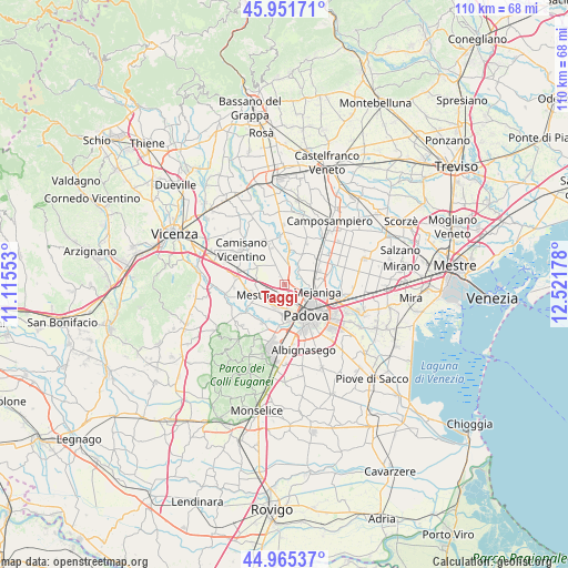
45° 27' 38.52" North, 11° 49' 7.14" East
| Map corner | latitude | longitude |
|---|---|---|
| Upper-left | 45.95171°, | 11.11553° |
| Center: | 45.4607°, | 11.81865° |
| Lower-right: | 44.96537°, | 12.52178° |
| Map W x H: | 109.7×109.7 km | = 68.2×68.2mi |
| max Lat: | 47.04031° ⇑27.8% North |
| Taggì: | 45.4607° |
| min Lat: | ⇓72.2% South 35.50142° |
| min Long | Taggì | max Long |
| 6.69888° | 11.81865° | 18.48682° |
| W 53.4%⇐ | ⇒46.6% E |
Elevation
Elevation of Taggì is 18 m = 59 ft, and this is 288.7 m = 947 ft below average elevation for this country.
| Max E: |
2085 m = 6841 ft | 90.1% |
| Avg. | 306.7 m = 1006 ft | |
| Taggì | 18 m = 59 ft | |
Min E: |
-4 m = -13 ft | 9.9% |
See also: Italy elevation on elevation.city.
Geographical zone
Taggì is located in North temperate zone (between Tropic of Cancer and the Arctic Circle). Distance of this North polar circle is 2346.4 km =1458 mi to North.| Distance of | km | miles | from Taggì |
|---|---|---|---|
| North Pole | 4952.3 | 3077.2 | to North |
| Arctic Circle | 2346.4 | 1458 | to North |
| Tropic Cancer | 2448.8 | 1521.6 | to South |
| Equator | 5054.8 | 3140.9 | to South |


Nearby cities:
15 places around Taggì: (largest is in red/bold)
• Bosco
2.7 km =1.7 mi,  223°
223°
• Caselle
5.5 km =3.4 mi,  181°
181°
• Limena
2.3 km =1.4 mi,  65°
65°
• Mestrino
5.1 km =3.2 mi,  245°
245°
• Ponterotto-Giustizia
1.2 km =0.7 mi,  140°
140°
• Prisco-Sandrin Piccolo
4.3 km =2.7 mi,  47°
47°
• Ronchi di Campanile
3.4 km =2.1 mi,  264°
264°
• Rubano
4.5 km =2.8 mi,  208°
208°
• Saletto
3.6 km =2.2 mi, 65°
• Sarmeola
4.1 km =2.5 mi, 182°
• Tavo
5.5 km =3.4 mi,  36°
36°
• Vaccarino
5.2 km =3.2 mi,  5°
5°
• Vigodarzere
5.2 km =3.2 mi,  93°
93°
• Villafranca Padovana
4 km =2.5 mi,  330°
330°
• Villaguattera
1.8 km =1.1 mi, 182°
Sources, notices
• [Note1] Compared only with cities in Italy existing in our database
• [Src1] Map data: © OpenStreetMap contributors (CC-BY-SA)
• [Src2] Other city data from geonames.org with taken over terms of usage.
• [Src3] Geographical zone / Annual Mean Temperature by Robert A. Rohde @ Wikipedia
