Caselle geodata
Caselle (Veneto) is a populated place; located in Italy in Europe/Rome (GMT+2) time zone. With population of 5,742 people, there are 1712 cities with bigger population in this country. Compared to other cities in Italy, 70.6% of cities are located further ↓South; 53.4% of cities are located further ←West and 92.1% of cities have higher elevation than Caselle. Note1


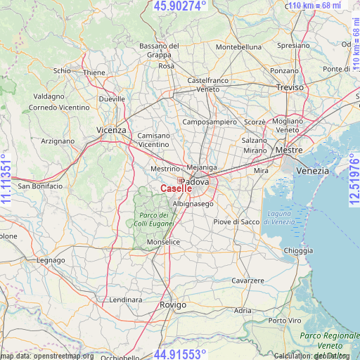
Caselle GPS coordinates[2]
45° 24' 40.644" North, 11° 48' 59.868" East
| Map corner | latitude | longitude |
|---|---|---|
| Upper-left | 45.90274°, | 11.11351° |
| Center: | 45.41129°, | 11.81663° |
| Lower-right: | 44.91553°, | 12.51976° |
| Map W x H: | 109.8×109.8 km | = 68.2×68.2mi |
| max Lat: | 47.04031° ⇑29.4% North |
| Caselle: | 45.41129° |
| min Lat: | ⇓70.6% South 35.50142° |
| min Long | Caselle | max Long |
| 6.69888° | 11.81663° | 18.48682° |
| W 53.4%⇐ | ⇒46.6% E |
Elevation
Elevation of Caselle is 14 m = 46 ft, and this is 292.7 m = 960 ft below average elevation for this country.
| Max E: |
2085 m = 6841 ft | 92.1% |
| Avg. | 306.7 m = 1006 ft | |
| Caselle | 14 m = 46 ft | |
Min E: |
-4 m = -13 ft | 7.9% |
See also: Italy elevation on elevation.city.
Geographical zone
Caselle is located in North temperate zone (between Tropic of Cancer and the Arctic Circle). Distance of this North polar circle is 2351.9 km =1461.4 mi to North.| Distance of | km | miles | from Caselle |
|---|---|---|---|
| North Pole | 4957.8 | 3080.6 | to North |
| Arctic Circle | 2351.9 | 1461.4 | to North |
| Tropic Cancer | 2443.3 | 1518.2 | to South |
| Equator | 5049.3 | 3137.5 | to South |


Nearby cities:
15 places around Caselle: (largest is in red/bold)
• Bosco
3.9 km =2.4 mi,  334°
334°
• Canton Madonna
4.2 km =2.6 mi,  288°
288°
• Feriole
6.3 km =3.9 mi,  230°
230°
• Mandriola-Sant'Agostino
5.4 km =3.4 mi,  150°
150°
• Mestrino
5.6 km =3.5 mi,  306°
306°
• Padova
5.4 km =3.4 mi,  93°
93°
• Ponterotto-Giustizia
4.7 km =2.9 mi,  11°
11°
• Ronchi di Campanile
6.1 km =3.8 mi, 327°
• Rubano
2.5 km =1.6 mi, 308°
• Saccolongo
5.4 km =3.4 mi,  258°
258°
• Sarmeola
1.4 km =0.9 mi,  0°
0°
• Selvazzano Dentro
3.2 km =2 mi,  215°
215°
• Taggì
5.5 km =3.4 mi, 1°
• Tencarola
1.9 km =1.2 mi,  197°
197°
• Villaguattera
3.6 km =2.2 mi, 1°
Sources, notices
• [Note1] Compared only with cities in Italy existing in our database
• [Src1] Map data: © OpenStreetMap contributors (CC-BY-SA)
• [Src2] Other city data from geonames.org with taken over terms of usage.
• [Src3] Geographical zone / Annual Mean Temperature by Robert A. Rohde @ Wikipedia
