San Vittore del Lazio geodata
San Vittore del Lazio (Latium) is a seat of a third-order administrative division; located in Italy in Europe/Rome (GMT+2) time zone. With population of 939 people, there are 6928 cities with bigger population in this country. Compared to other cities in Italy, 75.1% of cities are located further ↑North; 77.7% of cities are located further ←West and 55.5% of cities have higher elevation than San Vittore del Lazio. Note1
Administrative division(s):
- Level 1: Latium
- Level 2: Provincia di Frosinone
- Level 3: San Vittore del Lazio
Current local time in San Vittore del Lazio:
12:33 AM, ThursdayDifference from your time zone: hours


San Vittore del Lazio GPS coordinates[2]
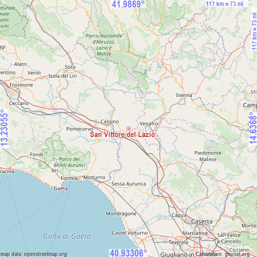
41° 27' 43.632" North, 13° 56' 1.212" East
| Map corner | latitude | longitude |
|---|---|---|
| Upper-left | 41.9869°, | 13.23055° |
| Center: | 41.46212°, | 13.93367° |
| Lower-right: | 40.93306°, | 14.6368° |
| Map W x H: | 117.2×117.2 km | = 72.8×72.8mi |
| max Lat: | 47.04031° ⇑75.1% North |
| San Vittore del Lazio: | 41.46212° |
| min Lat: | ⇓24.9% South 35.50142° |
| min Long | San Vittore del | max Long |
| 6.69888° | 13.93367° | 18.48682° |
| W 77.7%⇐ | ⇒22.3% E |
Elevation
Elevation of San Vittore del Lazio is 199 m = 653 ft, and this is 107.7 m = 353 ft below average elevation for this country.
| Max E: |
2085 m = 6841 ft | 55.5% |
| Avg. | 306.7 m = 1006 ft | |
| San Vittore del Lazio | 199 m = 653 ft | |
Min E: |
-4 m = -13 ft | 44.5% |
See also: Italy elevation on elevation.city.
Geographical zone
San Vittore del Lazio is located in North temperate zone (between Tropic of Cancer and the Arctic Circle). Distance of this Northern Tropic circle is 2004.2 km =1245.4 mi to South.| Distance of | km | miles | from San Vittore del Lazio |
|---|---|---|---|
| North Pole | 5396.9 | 3353.5 | to North |
| Arctic Circle | 2791 | 1734.2 | to North |
| Tropic Cancer | 2004.2 | 1245.4 | to South |
| Equator | 4610.2 | 2864.6 | to South |


Nearby cities:
15 places around San Vittore del Lazio: (largest is in red/bold)
• Acquafondata
9.1 km =5.7 mi,  10°
10°
• Bivio Mortola
8 km =5 mi,  202°
202°
• Cappella Morrone
6.1 km =3.8 mi,  299°
299°
• Cassino
9.2 km =5.7 mi,  286°
286°
• Ceppagna
6.8 km =4.2 mi,  89°
89°
• Cervaro
3.5 km =2.2 mi,  311°
311°
• Conca Casale
7.1 km =4.4 mi,  58°
58°
• Mignano Monte Lungo
7.6 km =4.7 mi,  145°
145°
• Pastenelle-Pacitti-Sprumaro
5 km =3.1 mi, 303°
• San Bartolomeo
6.7 km =4.2 mi, 289°
• San Pietro Infine
2.9 km =1.8 mi,  129°
129°
• Sant'Ambrogio sul Garigliano
9.3 km =5.8 mi,  215°
215°
• Sant'Elia Fiumerapido
9.9 km =6.2 mi,  323°
323°
• Venafro
9.8 km =6.1 mi,  76°
76°
• Viticuso
7.6 km =4.7 mi,  23°
23°
Sources, notices
• [Note1] Compared only with cities in Italy existing in our database
• [Src1] Map data: © OpenStreetMap contributors (CC-BY-SA)
• [Src2] Other city data from geonames.org with taken over terms of usage.
• [Src3] Geographical zone / Annual Mean Temperature by Robert A. Rohde @ Wikipedia
