Ceppagna geodata
Ceppagna (Molise) is a populated place; located in Italy in Europe/Rome (GMT+2) time zone. With population of 565 people, there are 9298 cities with bigger population in this country. Compared to other cities in Italy, 75.1% of cities are located further ↑North; 78.3% of cities are located further ←West and 50.3% of cities have higher elevation than Ceppagna. Note1


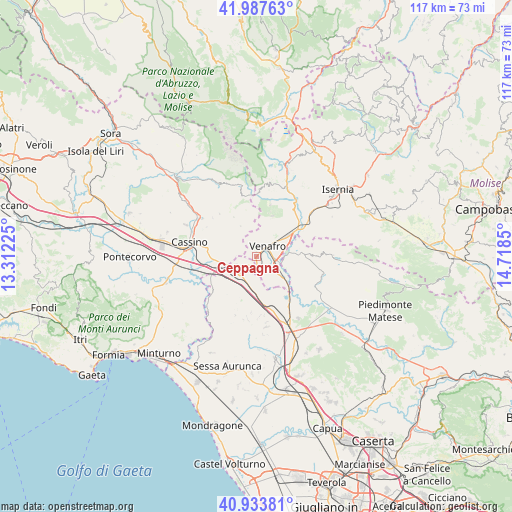
Ceppagna GPS coordinates[2]
41° 27' 46.296" North, 14° 0' 55.332" East
| Map corner | latitude | longitude |
|---|---|---|
| Upper-left | 41.98763°, | 13.31225° |
| Center: | 41.46286°, | 14.01537° |
| Lower-right: | 40.93381°, | 14.7185° |
| Map W x H: | 117.2×117.2 km | = 72.8×72.8mi |
| max Lat: | 47.04031° ⇑75.1% North |
| Ceppagna: | 41.46286° |
| min Lat: | ⇓24.9% South 35.50142° |
| min Long | Ceppagna | max Long |
| 6.69888° | 14.01537° | 18.48682° |
| W 78.3%⇐ | ⇒21.7% E |
Elevation
Elevation of Ceppagna is 233 m = 764 ft, and this is 73.7 m = 242 ft below average elevation for this country.
| Max E: |
2085 m = 6841 ft | 50.3% |
| Avg. | 306.7 m = 1006 ft | |
| Ceppagna | 233 m = 764 ft | |
Min E: |
-4 m = -13 ft | 49.7% |
See also: Italy elevation on elevation.city.
Geographical zone
Ceppagna is located in North temperate zone (between Tropic of Cancer and the Arctic Circle). Distance of this Northern Tropic circle is 2004.3 km =1245.4 mi to South.| Distance of | km | miles | from Ceppagna |
|---|---|---|---|
| North Pole | 5396.8 | 3353.4 | to North |
| Arctic Circle | 2790.9 | 1734.2 | to North |
| Tropic Cancer | 2004.3 | 1245.4 | to South |
| Equator | 4610.2 | 2864.6 | to South |


Nearby cities:
15 places around Ceppagna: (largest is in red/bold)
• Acquafondata
10.3 km =6.4 mi,  329°
329°
• Campopino
5.3 km =3.3 mi,  130°
130°
• Capriati A Volturno
10.9 km =6.8 mi,  86°
86°
• Cervaro
9.7 km =6 mi,  283°
283°
• Conca Casale
3.7 km =2.3 mi,  348°
348°
• Filignano
9.9 km =6.2 mi,  20°
20°
• Mignano Monte Lungo
6.8 km =4.2 mi,  201°
201°
• Pastenelle-Pacitti-Sprumaro
11.3 km =7 mi, 283°
• Pozzilli
6.7 km =4.2 mi,  36°
36°
• San Pietro Infine
5 km =3.1 mi,  247°
247°
• San Vittore del Lazio
6.8 km =4.2 mi,  269°
269°
• Selvotta
7.7 km =4.8 mi, 128°
• Sesto Campano
7 km =4.3 mi, 132°
• Venafro
3.5 km =2.2 mi,  50°
50°
• Viticuso
7.8 km =4.8 mi, 331°
Sources, notices
• [Note1] Compared only with cities in Italy existing in our database
• [Src1] Map data: © OpenStreetMap contributors (CC-BY-SA)
• [Src2] Other city data from geonames.org with taken over terms of usage.
• [Src3] Geographical zone / Annual Mean Temperature by Robert A. Rohde @ Wikipedia
