San Vito dei Normanni geodata
San Vito dei Normanni (Apulia) is a seat of a third-order administrative division; located in Italy in Europe/Rome (GMT+2) time zone. With population of 17,617 people, there are 501 cities with bigger population in this country. Compared to other cities in Italy, 82.9% of cities are located further ↑North; 98.7% of cities are located further ←West and 67.6% of cities have higher elevation than San Vito dei Normanni. Note1
Administrative division(s):
- Level 1: Apulia
- Level 2: Provincia di Brindisi
- Level 3: San Vito dei Normanni
Current local time in San Vito dei Normanni:
02:17 AM, WednesdayDifference from your time zone: hours


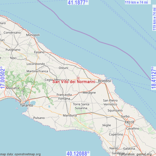
San Vito dei Normanni GPS coordinates[2]
40° 39' 23.112" North, 17° 42' 29.304" East
| Map corner | latitude | longitude |
|---|---|---|
| Upper-left | 41.1877°, | 17.00502° |
| Center: | 40.65642°, | 17.70814° |
| Lower-right: | 40.12088°, | 18.41127° |
| Map W x H: | 118.6×118.6 km | = 73.7×73.7mi |
| max Lat: | 47.04031° ⇑82.9% North |
| San Vito dei Normanni: | 40.65642° |
| min Lat: | ⇓17.1% South 35.50142° |
| min Long | San Vito dei No | max Long |
| 6.69888° | 17.70814° | 18.48682° |
| W 98.7%⇐ | ⇒1.3% E |
Elevation
Elevation of San Vito dei Normanni is 111 m = 364 ft, and this is 195.7 m = 642 ft below average elevation for this country.
| Max E: |
2085 m = 6841 ft | 67.6% |
| Avg. | 306.7 m = 1006 ft | |
| San Vito dei Normanni | 111 m = 364 ft | |
Min E: |
-4 m = -13 ft | 32.4% |
See also: Italy elevation on elevation.city.
Geographical zone
San Vito dei Normanni is located in North temperate zone (between Tropic of Cancer and the Arctic Circle). Distance of this Northern Tropic circle is 1914.7 km =1189.7 mi to South.| Distance of | km | miles | from San Vito dei Normanni |
|---|---|---|---|
| North Pole | 5486.5 | 3409.2 | to North |
| Arctic Circle | 2880.6 | 1789.9 | to North |
| Tropic Cancer | 1914.7 | 1189.7 | to South |
| Equator | 4520.6 | 2809 | to South |


Nearby cities:
15 places around San Vito dei Normanni: (largest is in red/bold)
• Betlemme
19.7 km =12.2 mi,  84°
84°
• Brindisi
19.4 km =12.1 mi,  97°
97°
• Carovigno
6.9 km =4.3 mi,  322°
322°
• Casalini
22 km =13.7 mi,  294°
294°
• Ceglie Messapica
16.2 km =10.1 mi,  265°
265°
• Francavilla Fontana
17.4 km =10.8 mi,  216°
216°
• La Rosa
21.3 km =13.2 mi,  105°
105°
• Latiano
11.8 km =7.3 mi,  175°
175°
• Materdomini
21.2 km =13.2 mi,  90°
90°
• Mesagne
13.8 km =8.6 mi,  142°
142°
• Oria
18.2 km =11.3 mi,  197°
197°
• Ostuni
13.7 km =8.5 mi,  306°
306°
• San Michele Salentino
6.9 km =4.3 mi,  246°
246°
• Torre Santa Susanna
21.2 km =13.2 mi,  173°
173°
• Villa Castelli
21.3 km =13.2 mi, 247°
Sources, notices
• [Note1] Compared only with cities in Italy existing in our database
• [Src1] Map data: © OpenStreetMap contributors (CC-BY-SA)
• [Src2] Other city data from geonames.org with taken over terms of usage.
• [Src3] Geographical zone / Annual Mean Temperature by Robert A. Rohde @ Wikipedia
