Sante Marie geodata
Sante Marie (Abruzzo) is a seat of a third-order administrative division; located in Italy in Europe/Rome (GMT+2) time zone. With population of 558 people, there are 9366 cities with bigger population in this country. Compared to other cities in Italy, 69.4% of cities are located further ↑North; 70.4% of cities are located further ←West and 94.7% of cities have lower elevation than Sante Marie. Note1


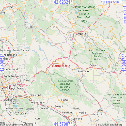
Sante Marie GPS coordinates[2]
42° 6' 13.284" North, 13° 12' 5.868" East
| Map corner | latitude | longitude |
|---|---|---|
| Upper-left | 42.62321°, | 12.49851° |
| Center: | 42.10369°, | 13.20163° |
| Lower-right: | 41.57987°, | 13.90476° |
| Map W x H: | 116×116 km | = 72.1×72.1mi |
| max Lat: | 47.04031° ⇑69.4% North |
| Sante Marie: | 42.10369° |
| min Lat: | ⇓30.6% South 35.50142° |
| min Long | Sante Marie | max Long |
| 6.69888° | 13.20163° | 18.48682° |
| W 70.4%⇐ | ⇒29.6% E |
Elevation
Elevation of Sante Marie is 863 m = 2831 ft, and this is 556.3 m = 1825 ft above average elevation for this country.
| Max E: |
2085 m = 6841 ft | 5.3% |
| Sante Marie | 863 m 2831 ft | |
| Avg. | 306.7 m = 1006 ft | |
Min E: |
-4 m = -13 ft | 94.7% |
See also: Italy elevation on elevation.city.
Geographical zone
Sante Marie is located in North temperate zone (between Tropic of Cancer and the Arctic Circle). Distance of this Northern Tropic circle is 2075.6 km =1289.7 mi to South.| Distance of | km | miles | from Sante Marie |
|---|---|---|---|
| North Pole | 5325.6 | 3309.2 | to North |
| Arctic Circle | 2719.7 | 1689.9 | to North |
| Tropic Cancer | 2075.6 | 1289.7 | to South |
| Equator | 4681.5 | 2908.9 | to South |


Nearby cities:
15 places around Sante Marie: (largest is in red/bold)
• Borgorose
10 km =6.2 mi,  14°
14°
• Camerata Nuova
12.2 km =7.6 mi,  218°
218°
• Cappadocia
12.4 km =7.7 mi,  149°
149°
• Carsoli
9.3 km =5.8 mi,  266°
266°
• Collalto Sabino
13.1 km =8.1 mi,  285°
285°
• Corvaro
12.5 km =7.8 mi,  24°
24°
• Magliano De'Marsi
13.4 km =8.3 mi,  95°
95°
• Nespolo
12.4 km =7.7 mi,  298°
298°
• Oricola
14.7 km =9.1 mi,  245°
245°
• Pereto
9.6 km =6 mi,  238°
238°
• Pescorocchiano
12.3 km =7.6 mi,  338°
338°
• Rocca di Botte
13.4 km =8.3 mi,  232°
232°
• Scurcola Marsicana
12.2 km =7.6 mi,  111°
111°
• Tagliacozzo
5.8 km =3.6 mi,  131°
131°
• Torano
7.3 km =4.5 mi,  40°
40°
Sources, notices
• [Note1] Compared only with cities in Italy existing in our database
• [Src1] Map data: © OpenStreetMap contributors (CC-BY-SA)
• [Src2] Other city data from geonames.org with taken over terms of usage.
• [Src3] Geographical zone / Annual Mean Temperature by Robert A. Rohde @ Wikipedia
