Sant'Andrea in Monte geodata
Sant'Andrea in Monte (Trentino-Alto Adige) is a populated place; located in Italy in Europe/Rome (GMT+2) time zone. With population of 664 people, there are 8532 cities with bigger population in this country. Compared to other cities in Italy, 99.3% of cities are located further ↓South; 51.5% of cities are located further ←West and 96.7% of cities have lower elevation than Sant'Andrea in Monte. Note1


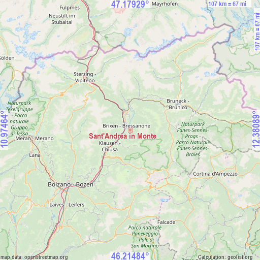
Sant'Andrea in Monte GPS coordinates[2]
46° 41' 57.192" North, 11° 40' 39.936" East
| Map corner | latitude | longitude |
|---|---|---|
| Upper-left | 47.17929°, | 10.97464° |
| Center: | 46.69922°, | 11.67776° |
| Lower-right: | 46.21484°, | 12.38089° |
| Map W x H: | 107.2×107.2 km | = 66.6×66.6mi |
| max Lat: | 47.04031° ⇑0.7% North |
| Sant'Andrea in Monte: | 46.69922° |
| min Lat: | ⇓99.3% South 35.50142° |
| min Long | Sant'Andrea in | max Long |
| 6.69888° | 11.67776° | 18.48682° |
| W 51.5%⇐ | ⇒48.5% E |
Elevation
Elevation of Sant'Andrea in Monte is 978 m = 3209 ft, and this is 671.3 m = 2202 ft above average elevation for this country.
| Max E: |
2085 m = 6841 ft | 3.3% |
| Sant'Andrea in Monte | 978 m 3209 ft | |
| Avg. | 306.7 m = 1006 ft | |
Min E: |
-4 m = -13 ft | 96.7% |
See also: Italy elevation on elevation.city.
Geographical zone
Sant'Andrea in Monte is located in North temperate zone (between Tropic of Cancer and the Arctic Circle). Distance of this North polar circle is 2208.7 km =1372.4 mi to North.| Distance of | km | miles | from Sant'Andrea in Monte |
|---|---|---|---|
| North Pole | 4814.6 | 2991.7 | to North |
| Arctic Circle | 2208.7 | 1372.4 | to North |
| Tropic Cancer | 2586.5 | 1607.2 | to South |
| Equator | 5192.5 | 3226.5 | to South |


Nearby cities:
15 places around Sant'Andrea in Monte: (largest is in red/bold)
• Albes
4.4 km =2.7 mi,  234°
234°
• Bressanone
2.4 km =1.5 mi,  316°
316°
• Funes - Villnoess
6.3 km =3.9 mi,  179°
179°
• Lazfons
10.2 km =6.3 mi,  251°
251°
• Leone-Santa Elisabetta
4.2 km =2.6 mi,  329°
329°
• Luson - Luesen
8.2 km =5.1 mi,  50°
50°
• Naz-Sciaves - Natz-Schabs
7.8 km =4.8 mi,  353°
353°
• Novacella
5.4 km =3.4 mi,  335°
335°
• Rodengo - Rodeneck
9 km =5.6 mi,  6°
6°
• San Pietro
6.4 km =4 mi, 176°
• Sciaves
7.8 km =4.8 mi, 353°
• Varna
5.4 km =3.4 mi, 325°
• Velturno
7.1 km =4.4 mi,  239°
239°
• Villa
8.3 km =5.2 mi, 51°
• Villa
9 km =5.6 mi, 6°
Sources, notices
• [Note1] Compared only with cities in Italy existing in our database
• [Src1] Map data: © OpenStreetMap contributors (CC-BY-SA)
• [Src2] Other city data from geonames.org with taken over terms of usage.
• [Src3] Geographical zone / Annual Mean Temperature by Robert A. Rohde @ Wikipedia
