Sant'Ambrogio geodata
Sant'Ambrogio (Veneto) is a populated place; located in Italy in Europe/Rome (GMT+2) time zone. With population of 827 people, there are 7518 cities with bigger population in this country. Compared to other cities in Italy, 77.3% of cities are located further ↓South; 57% of cities are located further ←West and 90.1% of cities have higher elevation than Sant'Ambrogio. Note1


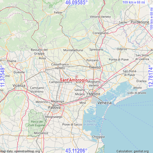
Sant'Ambrogio GPS coordinates[2]
45° 36' 21.996" North, 12° 4' 42.996" East
| Map corner | latitude | longitude |
|---|---|---|
| Upper-left | 46.09585°, | 11.37549° |
| Center: | 45.60611°, | 12.07861° |
| Lower-right: | 45.11206°, | 12.78174° |
| Map W x H: | 109.4×109.4 km | = 68×68mi |
| max Lat: | 47.04031° ⇑22.7% North |
| Sant'Ambrogio: | 45.60611° |
| min Lat: | ⇓77.3% South 35.50142° |
| min Long | Sant'Ambrogio | max Long |
| 6.69888° | 12.07861° | 18.48682° |
| W 57%⇐ | ⇒43% E |
Elevation
Elevation of Sant'Ambrogio is 18 m = 59 ft, and this is 288.7 m = 947 ft below average elevation for this country.
| Max E: |
2085 m = 6841 ft | 90.1% |
| Avg. | 306.7 m = 1006 ft | |
| Sant'Ambrogio | 18 m = 59 ft | |
Min E: |
-4 m = -13 ft | 9.9% |
See also: Italy elevation on elevation.city.
Geographical zone
Sant'Ambrogio is located in North temperate zone (between Tropic of Cancer and the Arctic Circle). Distance of this North polar circle is 2330.2 km =1447.9 mi to North.| Distance of | km | miles | from Sant'Ambrogio |
|---|---|---|---|
| North Pole | 4936.1 | 3067.1 | to North |
| Arctic Circle | 2330.2 | 1447.9 | to North |
| Tropic Cancer | 2465 | 1531.7 | to South |
| Equator | 5070.9 | 3150.9 | to South |


Nearby cities:
15 places around Sant'Ambrogio: (largest is in red/bold)
• Badoere
3.2 km =2 mi,  9°
9°
• Cappella
6.3 km =3.9 mi,  130°
130°
• Cappelletta
4.2 km =2.6 mi,  198°
198°
• Cavasagra
6.5 km =4 mi,  343°
343°
• Levada
2.7 km =1.7 mi,  320°
320°
• Moniego
5 km =3.1 mi,  172°
172°
• Ospedaletto
6.2 km =3.9 mi,  0°
0°
• Rio San Martino
3 km =1.9 mi,  120°
120°
• Ronchi
6.2 km =3.9 mi,  257°
257°
• Sant'Alberto
4.4 km =2.7 mi,  79°
79°
• Santa Cristina
6.3 km =3.9 mi,  48°
48°
• Scandolara
1.9 km =1.2 mi,  60°
60°
• Scorzè
4.4 km =2.7 mi,  144°
144°
• Torreselle
5.1 km =3.2 mi,  301°
301°
• Trebaseleghe
3.1 km =1.9 mi,  241°
241°
Sources, notices
• [Note1] Compared only with cities in Italy existing in our database
• [Src1] Map data: © OpenStreetMap contributors (CC-BY-SA)
• [Src2] Other city data from geonames.org with taken over terms of usage.
• [Src3] Geographical zone / Annual Mean Temperature by Robert A. Rohde @ Wikipedia
