San Secondo geodata
San Secondo (Umbria) is a populated place; located in Italy in Europe/Rome (GMT+2) time zone. With population of 1,199 people, there are 5960 cities with bigger population in this country. Compared to other cities in Italy, 60.5% of cities are located further ↑North; 59% of cities are located further ←West and 55.3% of cities have lower elevation than San Secondo. Note1
Administrative division(s):
- Level 1: Umbria
- Level 2: Provincia di Perugia
- Level 3: Città di Castello


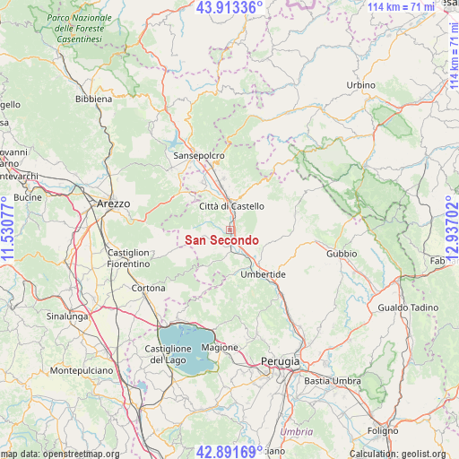
San Secondo GPS coordinates[2]
43° 24' 16.848" North, 12° 14' 2.004" East
| Map corner | latitude | longitude |
|---|---|---|
| Upper-left | 43.91336°, | 11.53077° |
| Center: | 43.40468°, | 12.23389° |
| Lower-right: | 42.89169°, | 12.93702° |
| Map W x H: | 113.6×113.6 km | = 70.6×70.6mi |
| max Lat: | 47.04031° ⇑60.5% North |
| San Secondo: | 43.40468° |
| min Lat: | ⇓39.5% South 35.50142° |
| min Long | San Secondo | max Long |
| 6.69888° | 12.23389° | 18.48682° |
| W 59%⇐ | ⇒41% E |
Elevation
Elevation of San Secondo is 267 m = 876 ft, and this is 39.7 m = 130 ft below average elevation for this country.
| Max E: |
2085 m = 6841 ft | 44.7% |
| Avg. | 306.7 m = 1006 ft | |
| San Secondo | 267 m = 876 ft | |
Min E: |
-4 m = -13 ft | 55.3% |
See also: Italy elevation on elevation.city.
Geographical zone
San Secondo is located in North temperate zone (between Tropic of Cancer and the Arctic Circle). Distance of this Northern Tropic circle is 2220.2 km =1379.6 mi to South.| Distance of | km | miles | from San Secondo |
|---|---|---|---|
| North Pole | 5180.9 | 3219.3 | to North |
| Arctic Circle | 2575 | 1600 | to North |
| Tropic Cancer | 2220.2 | 1379.6 | to South |
| Equator | 4826.1 | 2998.8 | to South |


Nearby cities:
15 places around San Secondo: (largest is in red/bold)
• Cerbara
10.7 km =6.6 mi,  350°
350°
• Citerna
14.3 km =8.9 mi,  317°
317°
• Città di Castello
6.8 km =4.2 mi,  2°
2°
• Lerchi
8.4 km =5.2 mi,  340°
340°
• Monte Santa Maria Tiberina
6.8 km =4.2 mi,  301°
301°
• Monterchi
13.6 km =8.5 mi,  312°
312°
• Montone
8.7 km =5.4 mi,  123°
123°
• Pietralunga
16.2 km =10.1 mi,  77°
77°
• Piosina
9.7 km =6 mi, 343°
• Pistrino
13.4 km =8.3 mi,  330°
330°
• Promano
5 km =3.1 mi,  145°
145°
• Selci-Lama
12.6 km =7.8 mi, 352°
• Trestina
4.3 km =2.7 mi,  176°
176°
• Umbertide
14 km =8.7 mi,  143°
143°
• Verna
5.6 km =3.5 mi, 176°
Sources, notices
• [Note1] Compared only with cities in Italy existing in our database
• [Src1] Map data: © OpenStreetMap contributors (CC-BY-SA)
• [Src2] Other city data from geonames.org with taken over terms of usage.
• [Src3] Geographical zone / Annual Mean Temperature by Robert A. Rohde @ Wikipedia
