Montone geodata
Montone (Umbria) is a seat of a third-order administrative division; located in Italy in Europe/Rome (GMT+2) time zone. With population of 567 people, there are 9283 cities with bigger population in this country. Compared to other cities in Italy, 60.7% of cities are located further ↑North; 60.2% of cities are located further ←West and 73.3% of cities have lower elevation than Montone. Note1


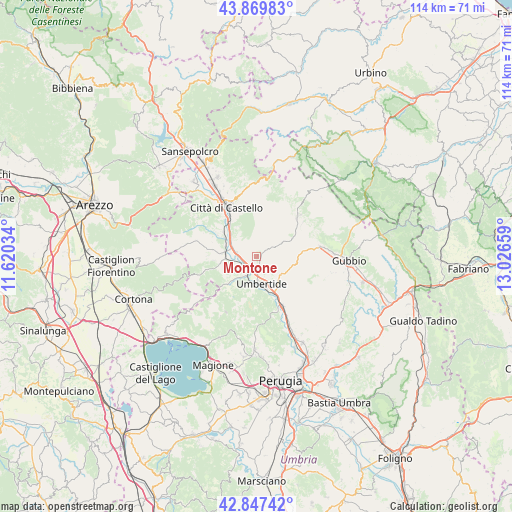
Montone GPS coordinates[2]
43° 21' 38.808" North, 12° 19' 24.456" East
| Map corner | latitude | longitude |
|---|---|---|
| Upper-left | 43.86983°, | 11.62034° |
| Center: | 43.36078°, | 12.32346° |
| Lower-right: | 42.84742°, | 13.02659° |
| Map W x H: | 113.7×113.7 km | = 70.6×70.6mi |
| max Lat: | 47.04031° ⇑60.7% North |
| Montone: | 43.36078° |
| min Lat: | ⇓39.3% South 35.50142° |
| min Long | Montone | max Long |
| 6.69888° | 12.32346° | 18.48682° |
| W 60.2%⇐ | ⇒39.8% E |
Elevation
Elevation of Montone is 429 m = 1407 ft, and this is 122.3 m = 401 ft above average elevation for this country.
| Max E: |
2085 m = 6841 ft | 26.7% |
| Montone | 429 m 1407 ft | |
| Avg. | 306.7 m = 1006 ft | |
Min E: |
-4 m = -13 ft | 73.3% |
See also: Italy elevation on elevation.city.
Geographical zone
Montone is located in North temperate zone (between Tropic of Cancer and the Arctic Circle). Distance of this Northern Tropic circle is 2215.3 km =1376.5 mi to South.| Distance of | km | miles | from Montone |
|---|---|---|---|
| North Pole | 5185.8 | 3222.3 | to North |
| Arctic Circle | 2579.9 | 1603.1 | to North |
| Tropic Cancer | 2215.3 | 1376.5 | to South |
| Equator | 4821.3 | 2995.8 | to South |


Nearby cities:
15 places around Montone: (largest is in red/bold)
• Città di Castello
13.6 km =8.5 mi,  329°
329°
• La Cinella
12.8 km =8 mi,  152°
152°
• Lerchi
16.2 km =10.1 mi,  321°
321°
• Monte Grimano
16.5 km =10.3 mi,  44°
44°
• Monte Santa Maria Tiberina
15.5 km =9.6 mi,  303°
303°
• Pierantonio
11.9 km =7.4 mi, 153°
• Pietralunga
12 km =7.5 mi,  45°
45°
• Piosina
17.4 km =10.8 mi, 324°
• Promano
4.5 km =2.8 mi,  279°
279°
• San Secondo
8.7 km =5.4 mi, 303°
• Semonte-Casamorcia
16.8 km =10.4 mi,  87°
87°
• Stazione di Parlesca e Solfagnano
17.3 km =10.7 mi,  155°
155°
• Trestina
7 km =4.3 mi,  274°
274°
• Umbertide
6.5 km =4 mi,  169°
169°
• Verna
7 km =4.3 mi,  263°
263°
Sources, notices
• [Note1] Compared only with cities in Italy existing in our database
• [Src1] Map data: © OpenStreetMap contributors (CC-BY-SA)
• [Src2] Other city data from geonames.org with taken over terms of usage.
• [Src3] Geographical zone / Annual Mean Temperature by Robert A. Rohde @ Wikipedia
