San Fior di Sopra geodata
San Fior di Sopra (Veneto) is a seat of a third-order administrative division; located in Italy in Europe/Rome (GMT+2) time zone. With population of 2,898 people, there are 3121 cities with bigger population in this country. Compared to other cities in Italy, 89.9% of cities are located further ↓South; 60.8% of cities are located further ←West and 78.5% of cities have higher elevation than San Fior di Sopra. Note1


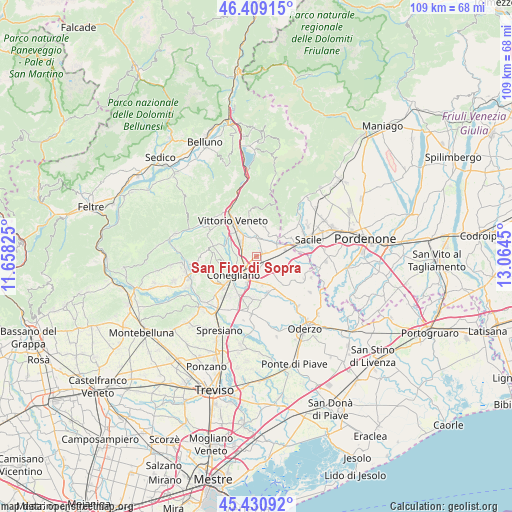
San Fior di Sopra GPS coordinates[2]
45° 55' 19.884" North, 12° 21' 40.932" East
| Map corner | latitude | longitude |
|---|---|---|
| Upper-left | 46.40915°, | 11.65825° |
| Center: | 45.92219°, | 12.36137° |
| Lower-right: | 45.43092°, | 13.0645° |
| Map W x H: | 108.8×108.8 km | = 67.6×67.6mi |
| max Lat: | 47.04031° ⇑10.1% North |
| San Fior di Sopra: | 45.92219° |
| min Lat: | ⇓89.9% South 35.50142° |
| min Long | San Fior di Sop | max Long |
| 6.69888° | 12.36137° | 18.48682° |
| W 60.8%⇐ | ⇒39.2% E |
Elevation
Elevation of San Fior di Sopra is 57 m = 187 ft, and this is 249.7 m = 819 ft below average elevation for this country.
| Max E: |
2085 m = 6841 ft | 78.5% |
| Avg. | 306.7 m = 1006 ft | |
| San Fior di Sopra | 57 m = 187 ft | |
Min E: |
-4 m = -13 ft | 21.5% |
See also: Italy elevation on elevation.city.
Geographical zone
San Fior di Sopra is located in North temperate zone (between Tropic of Cancer and the Arctic Circle). Distance of this North polar circle is 2295.1 km =1426.1 mi to North.| Distance of | km | miles | from San Fior di Sopra |
|---|---|---|---|
| North Pole | 4901 | 3045.3 | to North |
| Arctic Circle | 2295.1 | 1426.1 | to North |
| Tropic Cancer | 2500.1 | 1553.5 | to South |
| Equator | 5106.1 | 3172.8 | to South |


Nearby cities:
15 places around San Fior di Sopra: (largest is in red/bold)
• Bibano
5.8 km =3.6 mi,  106°
106°
• Cappella Maggiore
5.6 km =3.5 mi,  357°
357°
• Colle Umberto
2.7 km =1.7 mi,  326°
326°
• Cordignano
5.2 km =3.2 mi,  54°
54°
• Cosniga-Zoppè
3.9 km =2.4 mi,  181°
181°
• Godega
2.8 km =1.7 mi,  75°
75°
• Mescolino-Minelle
3.7 km =2.3 mi,  0°
0°
• Orsago
5.2 km =3.2 mi, 80°
• Saccon
5.4 km =3.4 mi,  189°
189°
• San Fior di Sotto
2.3 km =1.4 mi,  153°
153°
• San Martino
2.2 km =1.4 mi,  224°
224°
• San Martino
4.3 km =2.7 mi,  335°
335°
• San Vendemiano
3.9 km =2.4 mi, 190°
• San Vendemiano-Fossamerlo
4.2 km =2.6 mi, 215°
• Scomigo
3.9 km =2.4 mi,  305°
305°
Sources, notices
• [Note1] Compared only with cities in Italy existing in our database
• [Src1] Map data: © OpenStreetMap contributors (CC-BY-SA)
• [Src2] Other city data from geonames.org with taken over terms of usage.
• [Src3] Geographical zone / Annual Mean Temperature by Robert A. Rohde @ Wikipedia
