Godega geodata
Godega (Veneto) is a seat of a third-order administrative division; located in Italy in Europe/Rome (GMT+2) time zone. With population of 3,506 people, there are 2677 cities with bigger population in this country. Compared to other cities in Italy, 90% of cities are located further ↓South; 61.2% of cities are located further ←West and 79.3% of cities have higher elevation than Godega. Note1
Administrative division(s):
- Level 1: Veneto
- Level 2: Provincia di Treviso
- Level 3: Godega di Sant'Urbano


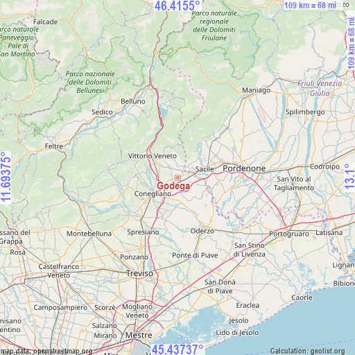
Godega GPS coordinates[2]
45° 55' 42.924" North, 12° 23' 48.732" East
| Map corner | latitude | longitude |
|---|---|---|
| Upper-left | 46.4155°, | 11.69375° |
| Center: | 45.92859°, | 12.39687° |
| Lower-right: | 45.43737°, | 13.1° |
| Map W x H: | 108.8×108.8 km | = 67.6×67.6mi |
| max Lat: | 47.04031° ⇑10% North |
| Godega: | 45.92859° |
| min Lat: | ⇓90% South 35.50142° |
| min Long | Godega | max Long |
| 6.69888° | 12.39687° | 18.48682° |
| W 61.2%⇐ | ⇒38.8% E |
Elevation
Elevation of Godega is 53 m = 174 ft, and this is 253.7 m = 832 ft below average elevation for this country.
| Max E: |
2085 m = 6841 ft | 79.3% |
| Avg. | 306.7 m = 1006 ft | |
| Godega | 53 m = 174 ft | |
Min E: |
-4 m = -13 ft | 20.7% |
See also: Italy elevation on elevation.city.
Geographical zone
Godega is located in North temperate zone (between Tropic of Cancer and the Arctic Circle). Distance of this North polar circle is 2294.4 km =1425.7 mi to North.| Distance of | km | miles | from Godega |
|---|---|---|---|
| North Pole | 4900.3 | 3044.9 | to North |
| Arctic Circle | 2294.4 | 1425.7 | to North |
| Tropic Cancer | 2500.9 | 1554 | to South |
| Equator | 5106.8 | 3173.2 | to South |


Nearby cities:
15 places around Godega: (largest is in red/bold)
• Bibano
3.6 km =2.2 mi,  130°
130°
• Cappella Maggiore
5.7 km =3.5 mi,  328°
328°
• Colle Umberto
4.5 km =2.8 mi,  289°
289°
• Cordignano
2.7 km =1.7 mi,  32°
32°
• Cosniga-Zoppè
5.4 km =3.4 mi,  211°
211°
• Mescolino-Minelle
4 km =2.5 mi,  317°
317°
• Orsago
2.3 km =1.4 mi,  87°
87°
• San Fior di Sopra
2.8 km =1.7 mi,  255°
255°
• San Fior di Sotto
3.3 km =2.1 mi, 211°
• San Martino
4.9 km =3 mi,  242°
242°
• San Martino
5.6 km =3.5 mi,  305°
305°
• San Vendemiano
5.8 km =3.6 mi,  217°
217°
• Sarmede
5.4 km =3.4 mi,  350°
350°
• Scomigo
6.1 km =3.8 mi,  284°
284°
• Villa di Villa
4.4 km =2.7 mi,  18°
18°
Sources, notices
• [Note1] Compared only with cities in Italy existing in our database
• [Src1] Map data: © OpenStreetMap contributors (CC-BY-SA)
• [Src2] Other city data from geonames.org with taken over terms of usage.
• [Src3] Geographical zone / Annual Mean Temperature by Robert A. Rohde @ Wikipedia
