San Damiano al Colle geodata
San Damiano al Colle (Lombardy) is a seat of a third-order administrative division; located in Italy in Europe/Rome (GMT+2) time zone. With population of 560 people, there are 9347 cities with bigger population in this country. Compared to other cities in Italy, 60.6% of cities are located further ↓South; 75.5% of cities are located further →East and 54.3% of cities have higher elevation than San Damiano al Colle. Note1
Administrative division(s):
- Level 1: Lombardy
- Level 2: Provincia di Pavia
- Level 3: San Damiano al Colle


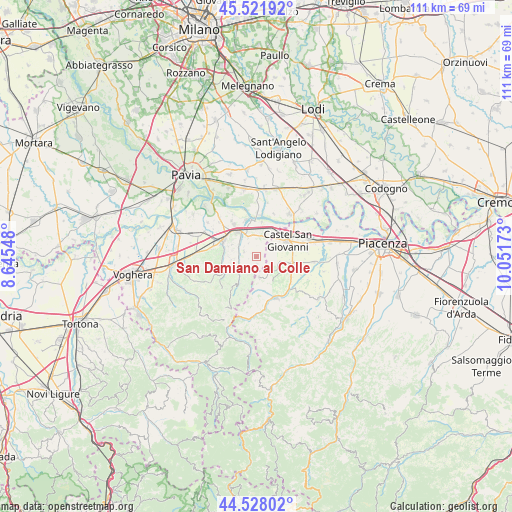
San Damiano al Colle GPS coordinates[2]
45° 1' 37.668" North, 9° 20' 54.96" East
| Map corner | latitude | longitude |
|---|---|---|
| Upper-left | 45.52192°, | 8.64548° |
| Center: | 45.02713°, | 9.3486° |
| Lower-right: | 44.52802°, | 10.05173° |
| Map W x H: | 110.5×110.5 km | = 68.7×68.7mi |
| max Lat: | 47.04031° ⇑39.4% North |
| San Damiano al Colle: | 45.02713° |
| min Lat: | ⇓60.6% South 35.50142° |
| min Long | San Damiano al | max Long |
| 6.69888° | 9.3486° | 18.48682° |
| W 24.5%⇐ | ⇒75.5% E |
Elevation
Elevation of San Damiano al Colle is 207 m = 679 ft, and this is 99.7 m = 327 ft below average elevation for this country.
| Max E: |
2085 m = 6841 ft | 54.3% |
| Avg. | 306.7 m = 1006 ft | |
| San Damiano al Colle | 207 m = 679 ft | |
Min E: |
-4 m = -13 ft | 45.7% |
See also: Italy elevation on elevation.city.
Geographical zone
San Damiano al Colle is located in North temperate zone (between Tropic of Cancer and the Arctic Circle). Distance of this North polar circle is 2394.6 km =1487.9 mi to North.| Distance of | km | miles | from San Damiano al Colle |
|---|---|---|---|
| North Pole | 5000.5 | 3107.2 | to North |
| Arctic Circle | 2394.6 | 1487.9 | to North |
| Tropic Cancer | 2400.6 | 1491.7 | to South |
| Equator | 5006.5 | 3110.9 | to South |


Nearby cities:
15 places around San Damiano al Colle: (largest is in red/bold)
• Arena Po
7.6 km =4.7 mi,  8°
8°
• Borgonovo Valtidone
7.6 km =4.7 mi,  100°
100°
• Bosnasco
4.2 km =2.6 mi, 9°
• Canneto
5.9 km =3.7 mi,  296°
296°
• Canneto Pavese
6.1 km =3.8 mi, 295°
• Castana
6 km =3.7 mi,  269°
269°
• Castel San Giovanni
7.9 km =4.9 mi,  62°
62°
• Montecalvo Versiggia
7.9 km =4.9 mi,  219°
219°
• Montescano
5.1 km =3.2 mi,  276°
276°
• Montù Beccaria
3 km =1.9 mi,  289°
289°
• Rovescala
2.3 km =1.4 mi,  185°
185°
• Santa Maria della Versa
5.8 km =3.6 mi, 221°
• Stradella
6.4 km =4 mi,  324°
324°
• Zenevredo
3.4 km =2.1 mi,  329°
329°
• Ziano Piacentino
4.7 km =2.9 mi,  129°
129°
Sources, notices
• [Note1] Compared only with cities in Italy existing in our database
• [Src1] Map data: © OpenStreetMap contributors (CC-BY-SA)
• [Src2] Other city data from geonames.org with taken over terms of usage.
• [Src3] Geographical zone / Annual Mean Temperature by Robert A. Rohde @ Wikipedia
