Rivignano geodata
Rivignano (Friuli Venezia Giulia) is a seat of a third-order administrative division; located in Italy in Europe/Rome (GMT+2) time zone. With population of 3,541 people, there are 2652 cities with bigger population in this country. Compared to other cities in Italy, 88.5% of cities are located further ↓South; 68.8% of cities are located further ←West and 92.1% of cities have higher elevation than Rivignano. Note1
Administrative division(s):
- Level 1: Friuli Venezia Giulia
- Level 2: Provincia di Udine
- Level 3: Rivignano Teor


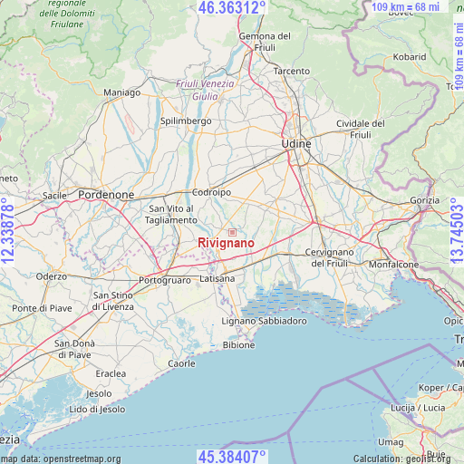
Rivignano GPS coordinates[2]
45° 52' 32.7" North, 13° 2' 30.84" East
| Map corner | latitude | longitude |
|---|---|---|
| Upper-left | 46.36312°, | 12.33878° |
| Center: | 45.87575°, | 13.0419° |
| Lower-right: | 45.38407°, | 13.74503° |
| Map W x H: | 108.9×108.9 km | = 67.7×67.7mi |
| max Lat: | 47.04031° ⇑11.5% North |
| Rivignano: | 45.87575° |
| min Lat: | ⇓88.5% South 35.50142° |
| min Long | Rivignano | max Long |
| 6.69888° | 13.0419° | 18.48682° |
| W 68.8%⇐ | ⇒31.2% E |
Elevation
Elevation of Rivignano is 14 m = 46 ft, and this is 292.7 m = 960 ft below average elevation for this country.
| Max E: |
2085 m = 6841 ft | 92.1% |
| Avg. | 306.7 m = 1006 ft | |
| Rivignano | 14 m = 46 ft | |
Min E: |
-4 m = -13 ft | 7.9% |
See also: Italy elevation on elevation.city.
Geographical zone
Rivignano is located in North temperate zone (between Tropic of Cancer and the Arctic Circle). Distance of this North polar circle is 2300.3 km =1429.3 mi to North.| Distance of | km | miles | from Rivignano |
|---|---|---|---|
| North Pole | 4906.2 | 3048.6 | to North |
| Arctic Circle | 2300.3 | 1429.3 | to North |
| Tropic Cancer | 2495 | 1550.3 | to South |
| Equator | 5100.9 | 3169.6 | to South |


Nearby cities:
15 places around Rivignano: (largest is in red/bold)
• Bertiolo
7.7 km =4.8 mi,  8°
8°
• Camino al Tagliamento
9.5 km =5.9 mi,  307°
307°
• Morsano
9 km =5.6 mi,  258°
258°
• Muzzana del Turgnano
9.2 km =5.7 mi,  134°
134°
• Palazzolo dello Stella
9.3 km =5.8 mi,  157°
157°
• Pocenia
6.4 km =4 mi, 133°
• Precenicco
9.1 km =5.7 mi, 163°
• Rivarotta
6.8 km =4.2 mi,  153°
153°
• Rivolto-Lonca
7.9 km =4.9 mi,  349°
349°
• Romans
3.2 km =2 mi,  326°
326°
• Ronchis
8.4 km =5.2 mi,  205°
205°
• Talmassons
8.5 km =5.3 mi,  46°
46°
• Teor
2.6 km =1.6 mi, 155°
• Torsa
5.8 km =3.6 mi,  92°
92°
• Varmo
4.2 km =2.6 mi,  286°
286°
Sources, notices
• [Note1] Compared only with cities in Italy existing in our database
• [Src1] Map data: © OpenStreetMap contributors (CC-BY-SA)
• [Src2] Other city data from geonames.org with taken over terms of usage.
• [Src3] Geographical zone / Annual Mean Temperature by Robert A. Rohde @ Wikipedia
