Morsano geodata
Morsano (Friuli Venezia Giulia) is a seat of a third-order administrative division; located in Italy in Europe/Rome (GMT+2) time zone. With population of 1,478 people, there are 5171 cities with bigger population in this country. Compared to other cities in Italy, 87.9% of cities are located further ↓South; 67.5% of cities are located further ←West and 91.5% of cities have higher elevation than Morsano. Note1
Administrative division(s):
- Level 1: Friuli Venezia Giulia
- Level 2: Provincia di Pordenone
- Level 3: Morsano al Tagliamento


Morsano GPS coordinates[2]
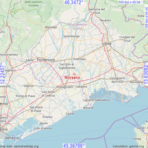
45° 51' 34.884" North, 12° 55' 39.684" East
| Map corner | latitude | longitude |
|---|---|---|
| Upper-left | 46.3472°, | 12.22457° |
| Center: | 45.85969°, | 12.92769° |
| Lower-right: | 45.36786°, | 13.63082° |
| Map W x H: | 108.9×108.9 km | = 67.7×67.7mi |
| max Lat: | 47.04031° ⇑12.1% North |
| Morsano: | 45.85969° |
| min Lat: | ⇓87.9% South 35.50142° |
| min Long | Morsano | max Long |
| 6.69888° | 12.92769° | 18.48682° |
| W 67.5%⇐ | ⇒32.5% E |
Elevation
Elevation of Morsano is 15 m = 49 ft, and this is 291.7 m = 957 ft below average elevation for this country.
| Max E: |
2085 m = 6841 ft | 91.5% |
| Avg. | 306.7 m = 1006 ft | |
| Morsano | 15 m = 49 ft | |
Min E: |
-4 m = -13 ft | 8.5% |
See also: Italy elevation on elevation.city.
Geographical zone
Morsano is located in North temperate zone (between Tropic of Cancer and the Arctic Circle). Distance of this North polar circle is 2302.1 km =1430.5 mi to North.| Distance of | km | miles | from Morsano |
|---|---|---|---|
| North Pole | 4907.9 | 3049.6 | to North |
| Arctic Circle | 2302.1 | 1430.5 | to North |
| Tropic Cancer | 2493.2 | 1549.2 | to South |
| Equator | 5099.1 | 3168.4 | to South |


Nearby cities:
15 places around Morsano: (largest is in red/bold)
• Bagnarola
5.4 km =3.4 mi,  278°
278°
• Camino al Tagliamento
7.7 km =4.8 mi,  9°
9°
• Casette
3.8 km =2.4 mi,  260°
260°
• Cintello
6.8 km =4.2 mi,  226°
226°
• Cordovado
3.7 km =2.3 mi,  242°
242°
• Fossalta di Portogruaro
7.5 km =4.7 mi,  190°
190°
• Gleris
5.7 km =3.5 mi,  314°
314°
• Gruaro
7.3 km =4.5 mi,  247°
247°
• Gruaro-Bagnara
6.3 km =3.9 mi, 251°
• Ramuscello
4.1 km =2.5 mi, 305°
• Ronchis
7.8 km =4.8 mi,  137°
137°
• San Giorgio al Tagliamento-Pozzi
7.6 km =4.7 mi,  158°
158°
• Savorgnano
7 km =4.3 mi, 305°
• Teglio Veneto
5.9 km =3.7 mi,  215°
215°
• Varmo
5.7 km =3.5 mi,  58°
58°
Sources, notices
• [Note1] Compared only with cities in Italy existing in our database
• [Src1] Map data: © OpenStreetMap contributors (CC-BY-SA)
• [Src2] Other city data from geonames.org with taken over terms of usage.
• [Src3] Geographical zone / Annual Mean Temperature by Robert A. Rohde @ Wikipedia
