Ripabianca geodata
Ripabianca (Umbria) is a populated place; located in Italy in Europe/Rome (GMT+2) time zone. With population of 571 people, there are 9253 cities with bigger population in this country. Compared to other cities in Italy, 63.7% of cities are located further ↑North; 61.3% of cities are located further ←West and 53.6% of cities have higher elevation than Ripabianca. Note1


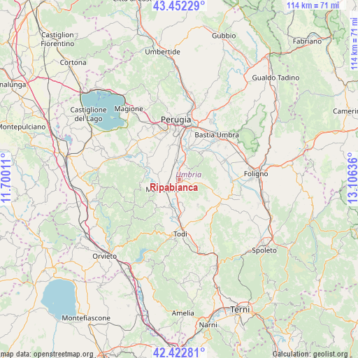
Ripabianca GPS coordinates[2]
42° 56' 22.92" North, 12° 24' 11.628" East
| Map corner | latitude | longitude |
|---|---|---|
| Upper-left | 43.45229°, | 11.70011° |
| Center: | 42.9397°, | 12.40323° |
| Lower-right: | 42.42281°, | 13.10636° |
| Map W x H: | 114.5×114.5 km | = 71.1×71.1mi |
| max Lat: | 47.04031° ⇑63.7% North |
| Ripabianca: | 42.9397° |
| min Lat: | ⇓36.3% South 35.50142° |
| min Long | Ripabianca | max Long |
| 6.69888° | 12.40323° | 18.48682° |
| W 61.3%⇐ | ⇒38.7% E |
Elevation
Elevation of Ripabianca is 213 m = 699 ft, and this is 93.7 m = 307 ft below average elevation for this country.
| Max E: |
2085 m = 6841 ft | 53.6% |
| Avg. | 306.7 m = 1006 ft | |
| Ripabianca | 213 m = 699 ft | |
Min E: |
-4 m = -13 ft | 46.4% |
See also: Italy elevation on elevation.city.
Geographical zone
Ripabianca is located in North temperate zone (between Tropic of Cancer and the Arctic Circle). Distance of this Northern Tropic circle is 2168.5 km =1347.4 mi to South.| Distance of | km | miles | from Ripabianca |
|---|---|---|---|
| North Pole | 5232.6 | 3251.4 | to North |
| Arctic Circle | 2626.7 | 1632.2 | to North |
| Tropic Cancer | 2168.5 | 1347.4 | to South |
| Equator | 4774.4 | 2966.7 | to South |


Nearby cities:
15 places around Ripabianca: (largest is in red/bold)
• Bettona
10.5 km =6.5 mi,  40°
40°
• Cerqueto
7 km =4.3 mi,  281°
281°
• Collazzone
5 km =3.1 mi,  148°
148°
• Collepepe
2.8 km =1.7 mi,  194°
194°
• Deruta
5.1 km =3.2 mi,  13°
13°
• Fornaci
8.8 km =5.5 mi, 8°
• Fratta Todina
9.8 km =6.1 mi,  199°
199°
• Marsciano
4.8 km =3 mi,  244°
244°
• Pantalla
7.4 km =4.6 mi,  182°
182°
• Ponte Nuovo
7.5 km =4.7 mi,  15°
15°
• San Niccolò di Celle
8.7 km =5.4 mi,  349°
349°
• San Terenziano
9.9 km =6.2 mi,  144°
144°
• Sant'Angelo di Celle
6.6 km =4.1 mi, 346°
• Sant'Enea
8.7 km =5.4 mi,  334°
334°
• Torgiano
10.2 km =6.3 mi, 17°
Sources, notices
• [Note1] Compared only with cities in Italy existing in our database
• [Src1] Map data: © OpenStreetMap contributors (CC-BY-SA)
• [Src2] Other city data from geonames.org with taken over terms of usage.
• [Src3] Geographical zone / Annual Mean Temperature by Robert A. Rohde @ Wikipedia
