Pantalla geodata
Pantalla (Umbria) is a populated place; located in Italy in Europe/Rome (GMT+2) time zone. With population of 1,430 people, there are 5292 cities with bigger population in this country. Compared to other cities in Italy, 64.2% of cities are located further ↑North; 61.2% of cities are located further ←West and 59.6% of cities have higher elevation than Pantalla. Note1


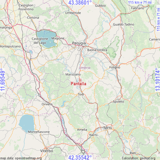
Pantalla GPS coordinates[2]
42° 52' 22.332" North, 12° 23' 54.996" East
| Map corner | latitude | longitude |
|---|---|---|
| Upper-left | 43.38601°, | 11.69549° |
| Center: | 42.87287°, | 12.39861° |
| Lower-right: | 42.35542°, | 13.10174° |
| Map W x H: | 114.6×114.6 km | = 71.2×71.2mi |
| max Lat: | 47.04031° ⇑64.2% North |
| Pantalla: | 42.87287° |
| min Lat: | ⇓35.8% South 35.50142° |
| min Long | Pantalla | max Long |
| 6.69888° | 12.39861° | 18.48682° |
| W 61.2%⇐ | ⇒38.8% E |
Elevation
Elevation of Pantalla is 166 m = 545 ft, and this is 140.7 m = 462 ft below average elevation for this country.
| Max E: |
2085 m = 6841 ft | 59.6% |
| Avg. | 306.7 m = 1006 ft | |
| Pantalla | 166 m = 545 ft | |
Min E: |
-4 m = -13 ft | 40.4% |
See also: Italy elevation on elevation.city.
Geographical zone
Pantalla is located in North temperate zone (between Tropic of Cancer and the Arctic Circle). Distance of this Northern Tropic circle is 2161.1 km =1342.8 mi to South.| Distance of | km | miles | from Pantalla |
|---|---|---|---|
| North Pole | 5240 | 3256 | to North |
| Arctic Circle | 2634.2 | 1636.8 | to North |
| Tropic Cancer | 2161.1 | 1342.8 | to South |
| Equator | 4767 | 2962.1 | to South |


Nearby cities:
15 places around Pantalla: (largest is in red/bold)
• Bastardo
13.1 km =8.1 mi,  90°
90°
• Cerqueto
11 km =6.8 mi,  323°
323°
• Collazzone
4.4 km =2.7 mi,  43°
43°
• Collepepe
4.7 km =2.9 mi,  356°
356°
• Deruta
12.5 km =7.8 mi,  7°
7°
• Fratta Todina
3.4 km =2.1 mi,  237°
237°
• Grutti
6.9 km =4.3 mi,  112°
112°
• Marcellano
9.6 km =6 mi, 89°
• Marsciano
6.6 km =4.1 mi, 323°
• Monte Castello di Vibio
5.2 km =3.2 mi,  226°
226°
• Ponterio-Pian di Porto
7.3 km =4.5 mi,  172°
172°
• Ripabianca
7.4 km =4.6 mi,  2°
2°
• San Terenziano
6.1 km =3.8 mi,  95°
95°
• San Venanzo
10.6 km =6.6 mi,  267°
267°
• Todi
10.5 km =6.5 mi, 174°
Sources, notices
• [Note1] Compared only with cities in Italy existing in our database
• [Src1] Map data: © OpenStreetMap contributors (CC-BY-SA)
• [Src2] Other city data from geonames.org with taken over terms of usage.
• [Src3] Geographical zone / Annual Mean Temperature by Robert A. Rohde @ Wikipedia
