Prignano sulla Secchia geodata
Prignano sulla Secchia (Emilia-Romagna) is a seat of a third-order administrative division; located in Italy in Europe/Rome (GMT+2) time zone. With population of 3,551 people, there are 2646 cities with bigger population in this country. Compared to other cities in Italy, 50.1% of cities are located further ↓South; 61% of cities are located further →East and 83.1% of cities have lower elevation than Prignano sulla Secchia. Note1
Administrative division(s):
- Level 1: Emilia-Romagna
- Level 2: Provincia di Modena
- Level 3: Prignano sulla Secchia
Current local time in Prignano sulla Secchia:
11:39 PM, WednesdayDifference from your time zone: hours


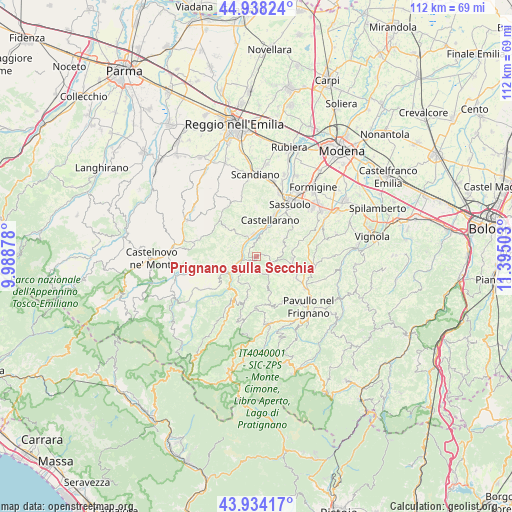
Prignano sulla Secchia GPS coordinates[2]
44° 26' 18.096" North, 10° 41' 30.84" East
| Map corner | latitude | longitude |
|---|---|---|
| Upper-left | 44.93824°, | 9.98878° |
| Center: | 44.43836°, | 10.6919° |
| Lower-right: | 43.93417°, | 11.39503° |
| Map W x H: | 111.6×111.6 km | = 69.3×69.3mi |
| max Lat: | 47.04031° ⇑49.9% North |
| Prignano sulla Secchia: | 44.43836° |
| min Lat: | ⇓50.1% South 35.50142° |
| min Long | Prignano sulla | max Long |
| 6.69888° | 10.6919° | 18.48682° |
| W 39%⇐ | ⇒61% E |
Elevation
Elevation of Prignano sulla Secchia is 574 m = 1883 ft, and this is 267.3 m = 877 ft above average elevation for this country.
| Max E: |
2085 m = 6841 ft | 16.9% |
| Prignano sulla Secchia | 574 m 1883 ft | |
| Avg. | 306.7 m = 1006 ft | |
Min E: |
-4 m = -13 ft | 83.1% |
See also: Italy elevation on elevation.city.
Geographical zone
Prignano sulla Secchia is located in North temperate zone (between Tropic of Cancer and the Arctic Circle). Distance of this Northern Tropic circle is 2335.2 km =1451 mi to South.| Distance of | km | miles | from Prignano sulla Secchia |
|---|---|---|---|
| North Pole | 5066 | 3147.9 | to North |
| Arctic Circle | 2460.1 | 1528.6 | to North |
| Tropic Cancer | 2335.2 | 1451 | to South |
| Equator | 4941.1 | 3070.3 | to South |


Nearby cities:
15 places around Prignano sulla Secchia: (largest is in red/bold)
• Baiso
9.7 km =6 mi,  311°
311°
• Cadiroggio
13 km =8.1 mi,  18°
18°
• Castellarano
9.6 km =6 mi, 22°
• Cavola
13.4 km =8.3 mi,  251°
251°
• Montefiorino
10.8 km =6.7 mi,  209°
209°
• Palagano
13.5 km =8.4 mi,  195°
195°
• Polinago
10.7 km =6.6 mi,  165°
165°
• Prignano
0.1 km =0.1 mi,  228°
228°
• Roteglia
5.1 km =3.2 mi,  356°
356°
• San Michele dei Mucchietti
8.9 km =5.5 mi,  29°
29°
• Sant'Antonio
14 km =8.7 mi,  125°
125°
• Sassuolo
13.8 km =8.6 mi, 32°
• Serramazzoni
7.9 km =4.9 mi,  98°
98°
• Toano
12.4 km =7.7 mi,  235°
235°
• Viano
13 km =8.1 mi,  335°
335°
Sources, notices
• [Note1] Compared only with cities in Italy existing in our database
• [Src1] Map data: © OpenStreetMap contributors (CC-BY-SA)
• [Src2] Other city data from geonames.org with taken over terms of usage.
• [Src3] Geographical zone / Annual Mean Temperature by Robert A. Rohde @ Wikipedia
