Cadiroggio geodata
Cadiroggio (Emilia-Romagna) is a populated place; located in Italy in Europe/Rome (GMT+2) time zone. With population of 798 people, there are 7660 cities with bigger population in this country. Compared to other cities in Italy, 51.7% of cities are located further ↓South; 60.5% of cities are located further →East and 53.4% of cities have higher elevation than Cadiroggio. Note1
Administrative division(s):
- Level 1: Emilia-Romagna
- Level 2: Provincia di Reggio Emilia
- Level 3: Castellarano


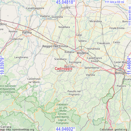
Cadiroggio GPS coordinates[2]
44° 32' 57.336" North, 10° 44' 34.476" East
| Map corner | latitude | longitude |
|---|---|---|
| Upper-left | 45.04818°, | 10.03979° |
| Center: | 44.54926°, | 10.74291° |
| Lower-right: | 44.04602°, | 11.44604° |
| Map W x H: | 111.4×111.4 km | = 69.2×69.2mi |
| max Lat: | 47.04031° ⇑48.3% North |
| Cadiroggio: | 44.54926° |
| min Lat: | ⇓51.7% South 35.50142° |
| min Long | Cadiroggio | max Long |
| 6.69888° | 10.74291° | 18.48682° |
| W 39.5%⇐ | ⇒60.5% E |
Elevation
Elevation of Cadiroggio is 214 m = 702 ft, and this is 92.7 m = 304 ft below average elevation for this country.
| Max E: |
2085 m = 6841 ft | 53.4% |
| Avg. | 306.7 m = 1006 ft | |
| Cadiroggio | 214 m = 702 ft | |
Min E: |
-4 m = -13 ft | 46.6% |
See also: Italy elevation on elevation.city.
Geographical zone
Cadiroggio is located in North temperate zone (between Tropic of Cancer and the Arctic Circle). Distance of this Northern Tropic circle is 2347.5 km =1458.7 mi to South.| Distance of | km | miles | from Cadiroggio |
|---|---|---|---|
| North Pole | 5053.6 | 3140.2 | to North |
| Arctic Circle | 2447.8 | 1521 | to North |
| Tropic Cancer | 2347.5 | 1458.7 | to South |
| Equator | 4953.4 | 3077.9 | to South |


Nearby cities:
15 places around Cadiroggio: (largest is in red/bold)
• Arceto
7.7 km =4.8 mi,  349°
349°
• Ca' de' Caroli
6.9 km =4.3 mi,  308°
308°
• Casalgrande
4 km =2.5 mi, 351°
• Castellarano
3.5 km =2.2 mi,  187°
187°
• Fellegara
7.7 km =4.8 mi,  331°
331°
• Fiorano
5.6 km =3.5 mi,  101°
101°
• Magreta
7.2 km =4.5 mi,  38°
38°
• Pratissolo
8.2 km =5.1 mi,  318°
318°
• Roteglia
8.4 km =5.2 mi,  210°
210°
• Salvaterra
5.9 km =3.7 mi,  20°
20°
• San Michele dei Mucchietti
4.5 km =2.8 mi,  175°
175°
• Sassuolo
3.4 km =2.1 mi, 101°
• Scandiano
6.6 km =4.1 mi, 325°
• Veggia-Villalunga
1.7 km =1.1 mi, 39°
• Ventoso
6 km =3.7 mi, 313°
Sources, notices
• [Note1] Compared only with cities in Italy existing in our database
• [Src1] Map data: © OpenStreetMap contributors (CC-BY-SA)
• [Src2] Other city data from geonames.org with taken over terms of usage.
• [Src3] Geographical zone / Annual Mean Temperature by Robert A. Rohde @ Wikipedia
