Polverara geodata
Polverara (Veneto) is a seat of a third-order administrative division; located in Italy in Europe/Rome (GMT+2) time zone. With population of 2,283 people, there are 3779 cities with bigger population in this country. Compared to other cities in Italy, 67.7% of cities are located further ↓South; 55.3% of cities are located further ←West and 97.2% of cities have higher elevation than Polverara. Note1


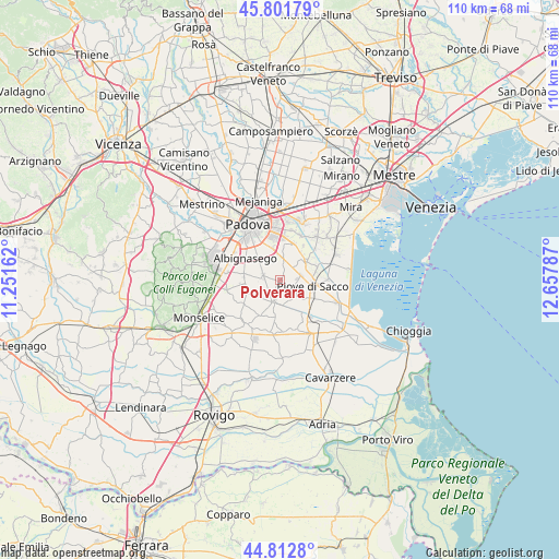
Polverara GPS coordinates[2]
45° 18' 34.02" North, 11° 57' 17.064" East
| Map corner | latitude | longitude |
|---|---|---|
| Upper-left | 45.80179°, | 11.25162° |
| Center: | 45.30945°, | 11.95474° |
| Lower-right: | 44.8128°, | 12.65787° |
| Map W x H: | 110×110 km | = 68.4×68.4mi |
| max Lat: | 47.04031° ⇑32.3% North |
| Polverara: | 45.30945° |
| min Lat: | ⇓67.7% South 35.50142° |
| min Long | Polverara | max Long |
| 6.69888° | 11.95474° | 18.48682° |
| W 55.3%⇐ | ⇒44.7% E |
Elevation
Elevation of Polverara is 5 m = 16 ft, and this is 301.7 m = 990 ft below average elevation for this country.
| Max E: |
2085 m = 6841 ft | 97.2% |
| Avg. | 306.7 m = 1006 ft | |
| Polverara | 5 m = 16 ft | |
Min E: |
-4 m = -13 ft | 2.8% |
See also: Italy elevation on elevation.city.
Geographical zone
Polverara is located in North temperate zone (between Tropic of Cancer and the Arctic Circle). Distance of this North polar circle is 2363.2 km =1468.4 mi to North.| Distance of | km | miles | from Polverara |
|---|---|---|---|
| North Pole | 4969.1 | 3087.7 | to North |
| Arctic Circle | 2363.2 | 1468.4 | to North |
| Tropic Cancer | 2432 | 1511.2 | to South |
| Equator | 5037.9 | 3130.4 | to South |


Nearby cities:
15 places around Polverara: (largest is in red/bold)
• Arzerello
6.8 km =4.2 mi,  125°
125°
• Bertipaglia
5.5 km =3.4 mi,  277°
277°
• Bovolenta
4.7 km =2.9 mi,  198°
198°
• Brugine
3.2 km =2 mi,  115°
115°
• Campagnola
4.9 km =3 mi, 134°
• Campolongo Maggiore
7.1 km =4.4 mi,  77°
77°
• Campolongo Maggiore Liettoli
6.4 km =4 mi,  58°
58°
• Casalserugo
3.4 km =2.1 mi, 281°
• Legnaro
3.7 km =2.3 mi,  12°
12°
• Maserà di Padova
7.1 km =4.4 mi, 277°
• Piove di Sacco-Piovega
6.6 km =4.1 mi,  102°
102°
• Ponte San Nicolò
6.9 km =4.3 mi,  339°
339°
• Roncajette
4.2 km =2.6 mi, 341°
• Sant'Angelo di Piove di Sacco
4.4 km =2.7 mi, 78°
• Saonara
6.6 km =4.1 mi,  20°
20°
Sources, notices
• [Note1] Compared only with cities in Italy existing in our database
• [Src1] Map data: © OpenStreetMap contributors (CC-BY-SA)
• [Src2] Other city data from geonames.org with taken over terms of usage.
• [Src3] Geographical zone / Annual Mean Temperature by Robert A. Rohde @ Wikipedia
