Pergine Valdarno geodata
Pergine Valdarno (Tuscany) is a seat of a third-order administrative division; located in Italy in Europe/Rome (GMT+2) time zone. With population of 577 people, there are 9203 cities with bigger population in this country. Compared to other cities in Italy, 60.1% of cities are located further ↑North; 51.6% of cities are located further ←West and 67.5% of cities have lower elevation than Pergine Valdarno. Note1
Administrative division(s):
- Level 1: Tuscany
- Level 2: Province of Arezzo
- Level 3: Laterina Pergine Valdarno


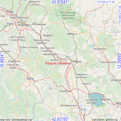
Pergine Valdarno GPS coordinates[2]
43° 28' 13.008" North, 11° 41' 7.872" East
| Map corner | latitude | longitude |
|---|---|---|
| Upper-left | 43.97841°, | 10.9824° |
| Center: | 43.47028°, | 11.68552° |
| Lower-right: | 42.95785°, | 12.38865° |
| Map W x H: | 113.5×113.5 km | = 70.5×70.5mi |
| max Lat: | 47.04031° ⇑60.1% North |
| Pergine Valdarno: | 43.47028° |
| min Lat: | ⇓39.9% South 35.50142° |
| min Long | Pergine Valdarn | max Long |
| 6.69888° | 11.68552° | 18.48682° |
| W 51.6%⇐ | ⇒48.4% E |
Elevation
Elevation of Pergine Valdarno is 368 m = 1207 ft, and this is 61.3 m = 201 ft above average elevation for this country.
| Max E: |
2085 m = 6841 ft | 32.5% |
| Pergine Valdarno | 368 m 1207 ft | |
| Avg. | 306.7 m = 1006 ft | |
Min E: |
-4 m = -13 ft | 67.5% |
See also: Italy elevation on elevation.city.
Geographical zone
Pergine Valdarno is located in North temperate zone (between Tropic of Cancer and the Arctic Circle). Distance of this Northern Tropic circle is 2227.5 km =1384.1 mi to South.| Distance of | km | miles | from Pergine Valdarno |
|---|---|---|---|
| North Pole | 5173.6 | 3214.7 | to North |
| Arctic Circle | 2567.7 | 1595.5 | to North |
| Tropic Cancer | 2227.5 | 1384.1 | to South |
| Equator | 4833.4 | 3003.3 | to South |


Nearby cities:
15 places around Pergine Valdarno: (largest is in red/bold)
• Ambra
9.1 km =5.7 mi,  227°
227°
• Badia Agnano
4.8 km =3 mi,  216°
216°
• Badia al Pino
10.1 km =6.3 mi,  136°
136°
• Battifolle-Ruscello-Poggiola
9.5 km =5.9 mi,  103°
103°
• Bucine
5.8 km =3.6 mi,  277°
277°
• Castiglion Fibocchi
8.8 km =5.5 mi,  43°
43°
• Cavi-Casalone
2.1 km =1.3 mi,  61°
61°
• Civitella in Val di Chiana
6.6 km =4.1 mi,  152°
152°
• Laterina
4.4 km =2.7 mi, 36°
• Montalto
3.7 km =2.3 mi,  331°
331°
• Ponticino
2.7 km =1.7 mi,  66°
66°
• Pratantico-Indicatore
9.7 km =6 mi,  83°
83°
• San Giustino Valdarno
9.3 km =5.8 mi,  9°
9°
• Torre
9.9 km =6.2 mi, 275°
• Viciomaggio
8.3 km =5.2 mi,  120°
120°
Sources, notices
• [Note1] Compared only with cities in Italy existing in our database
• [Src1] Map data: © OpenStreetMap contributors (CC-BY-SA)
• [Src2] Other city data from geonames.org with taken over terms of usage.
• [Src3] Geographical zone / Annual Mean Temperature by Robert A. Rohde @ Wikipedia
